
Whiteoak Green
About Whiteoak Green
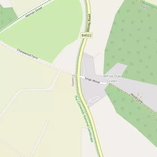
Whiteoak Green sits within Oxfordshire. Neighbouring places include Delly End lying 1.2 km South East, Hailey lying 1.6 km South East, Ramsden lying 1.8 km North East and Crawley just 2.1 km South. Other rural communities nearby include Field Assarts, Wilcote, Fordwells, Asthall Leigh and Fawler.
You might learn something new by clicking through to a nearby place.
All place information is taken from OS, ONS and OSM under open licence.
⇅
Local Map
⇅
Location Summary
- Whiteoak Green is located in Oxfordshire
- Administrative Area: Oxfordshire
- Ceremonial County: Oxfordshire
- Historic County: Oxfordshire
- Region & Country: South East / England
⇅
Nearby Towns & Cities
⇅
Nearby Localities
⇅
Smaller Settlements
⇅
Beaches
- Cotswold Hills Beach
- Goatee Beach
- Sugar Loaf Beach
⇅
Parks
- Loop Meadow
- Merton Field
- The Green
- The Green
⇅
Woods
- Blindwell Wood
- Easewell Copse
- Saint John's Wood
- Studley Copse
⇅
Hills
- David's Hill
- Hatching Hill
- Maple Hill
- Patch Hill
⇅
Lakes
- Corner Hole
- Newhill Pond
- Ridge Pool
- The Horseshoe
⇅
Waterfalls
- Neptune Waterfall
- The Cascade
- Tower Waterfall
⇅
Headlands
- Beachley Point
- Botany Bay Point
⇅
Islands
- Fiddler's Island
- Isle of Rhea
⇅
Wetlands
- Ranger's Marsh
- Brassey
- Wanborough Marsh
⇅
Health Services
- Witney Community Hospital
- Chipping Norton War Memorial Community Hospital
- Middletown Grange
- Merryfield House
⇅
Education
- Hailey Church of England Primary School
- Common Leys Farm Campus
- Common Leys Farm Campus
⇅
Train Stations
- Finstock
- Charlbury
⇅
Bus Stations
- Swindon Bus Station
- Aylesbury Bus Station
⇅
Coach Stations
- Shakespeare's Birthplace Coach Terminal
- High Wycombe Coachway
⇅
Ferry Terminals
- Harbour Inlet Ferry Landing
- SS Great Britain Ferry Landing
⇅
Airports
- London Oxford Airport
- Wellesbourne Mountford Airfield
⇅
Airfields
- RAF Brize Norton
⇅
Heliports
- The London Heliport
⇅
Harbours
- Lydney Harbour
- Floating Harbour