
Willoughton
About Willoughton
Willoughton is in Lincolnshire. Nearby places include Hemswell only 2.3 km South, Grayingham around 2.9 km North, Hemswell Cliff just 4.5 km South South East, Northorpe just 5.2 km North West and Bishop Norton situated 5.4 km East. Other countryside settlements include Blyborough, Harpswell, Yawthorpe and Spital in the Street.
You may notice something interesting if you explore one of the nearby places.
The place data here is drawn from OS, ONS and OSM under open licence.
⇅
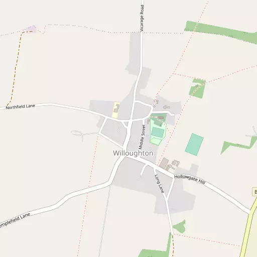
Local Map
⇅
Location Summary
- Willoughton is located in Lincolnshire
- Administrative Area: Lincolnshire
- Ceremonial County: Lincolnshire
- Historic County: Lincolnshire
- Region & Country: East Midlands / England
⇅
Nearby Towns & Cities
- Kirton in Lindsey 5.3 km N
- Gainsborough 11.8 km WSW
- Brigg 15.7 km NNE
- Market Rasen 18.1 km ESE
- Lincoln 21.9 km S


⇅
Nearby Localities
- HemswellVillage 2.3 km S
- GrayinghamVillage 2.9 km N
- Hemswell CliffVillage 4.5 km SSE
- NorthorpeVillage 5.2 km NW
- Bishop NortonVillage 5.4 km E
- GlentworthVillage 5.4 km SSE
- SnitterbyVillage 5.6 km ENE
- WaddinghamVillage 5.9 km ENE
- CorringhamVillage 6.2 km WSW
- SpringthorpeVillage 6.5 km WSW


⇅
Smaller Settlements
- Blyborough 1.1 km NNE
- Harpswell 3.5 km S
- Yawthorpe 3.7 km WSW
- Spital in the Street 4.9 km SE
- Atterby 5.1 km E
- Caenby Corner 5.2 km SE
- Aisby 5.8 km W
- Sturgate 6.5 km SW
- Pilham 6.8 km W
- Caenby 7.9 km ESE


⇅
Beaches
- Cleethorpes Beach41.3 km ENE
- Ellerker Foreshore33.4 km N
- Whitgift Sand32.1 km NNW

⇅
Parks
- Burgage Green45.0 km SSW
- Doncaster Common34.0 km WNW
- Killamarsh Meadows48.9 km WSW
- Wilsford Warren50.7 km S


⇅
Woods
- Blyborough Covert2.2 km WNW
- Huckerby Gorse3.2 km WNW
- Spring Hills2.0 km S
- Yawthorpe Fox Covert3.0 km WSW
⇅
Hills
- Bran's Hill10.5 km W
- Harpswell Hill3.4 km S
- Newel Well Hill6.1 km SE
- Pheasant Hill10.3 km W
⇅
Lakes
- Ash Holt Reservoir8.0 km N
- Great Fish Pond7.7 km NE
- The Lake7.5 km S
- The Lake8.6 km W

⇅
Waterfalls
- Goitstock Waterfall95.5 km WNW
- Kinder Downfall84.6 km W
- Lumb Fall94.0 km WNW
⇅
Headlands
- Flamborough Head83.7 km NNE
- Red Cliff Point92.0 km N
⇅
Islands
- Branston Island28.2 km SE
- Torksey Island17.0 km SW
⇅
Wetlands
- Lea Marsh13.4 km WSW
- Laughterton Marsh20.0 km SSW
- The Island Sand29.0 km NNW
⇅
Health Services
- The Priory HospitalHospital 4.9 km SSE
- John Coupland HospitalHospital 12.3 km W
- Lowfield House Care HomeMedical 4.9 km N
- Holly Tree Lodge Nursing HomeMedical 7.1 km NNW
⇅
Education
- Willoughton Primary SchoolSchool 104 m NW
- Hemswell Cliff Primary SchoolSchool 3.9 km SSE
- Showground CampusUniversity 15.7 km SSE
⇅
Railway Stations
- Kirton Lindsey6.4 km N
- Gainsborough Central11.6 km WSW
⇅
Bus Stations
- Scunthorpe Bus Station18.3 km N
- Lincoln Central Bus Station22.8 km S
⇅
Coach Stations
- Meadowhall Interchange53.8 km W
- Chesterfield Coach Station59.0 km WSW
⇅
Ferry Terminals
- Hull Ferry Port40.9 km NNE
- Normanton Chain Ferry81.5 km SSW
⇅
Airports
- Wickenby Aerodrome20.7 km SE
- Humberside Airport23.6 km NE
⇅
Airfields
- Sturgate Airfield7.2 km SW
- Hibaldstow Airfield9.5 km NE
⇅
Heliports
- Lincs and Notts Air Ambulance HQ29.2 km SSE
- Nottingham Heliport71.5 km SSW
⇅
Harbours
- South Killingholme Haven35.4 km NE
- Old Harbour39.2 km NNE