
Yarnacott, Swimbridge
About Yarnacott
Yarnacott lies 513 m SSW from Swimbridge in Devon. Local places nearby include Swimbridge only 513 m South South West, Swimbridge Newland only 2.0 km West, Landkey situated 2.6 km West North West and Landkey Newland only 2.9 km West North West. Other nearby settlements include Kerscott, Hannaford, Harford, Gunn and Heddon.
You may notice something interesting if you explore one of the nearby places.
All information is drawn from OS, ONS and OSM under open licence, reflecting the best available public data.
⇅
Local Map
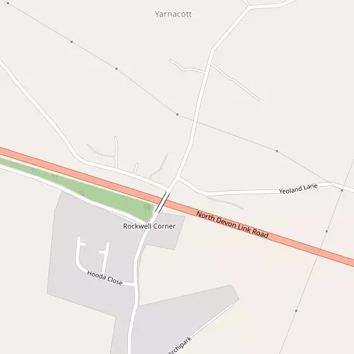
⇅
Location Summary
- Yarnacott is a neighbourhood in Swimbridge
- Administrative Area: Devon
- Ceremonial County: Devon
- Historic County: Devon
- Region & Country: South West / England
⇅
Nearby Towns & Cities
- Parent town: Swimbridge
- Barnstaple 6.9 km WNW
- South Molton 10.3 km ESE
- Great Torrington 17.0 km SW
- Bideford 17.2 km WSW
- Exeter 48.1 km SE


⇅
Nearby Localities
- SwimbridgeVillage 513 m SSW
- Swimbridge NewlandDistrict 2.0 km W
- LandkeyVillage 2.6 km WNW
- Landkey NewlandDistrict 2.9 km WNW
- Landkey TownDistrict 3.1 km W
- West BucklandVillage 3.6 km ENE
- GoodleighVillage 4.4 km NNW
- WestacottVillage 4.5 km WNW
- Stoke RiversVillage 5.0 km N
- ChittlehamptonVillage 5.2 km SSE


⇅
Smaller Settlements


⇅
Beaches
- Horsey Ridge14.9 km W
- Instow Beach15.1 km W
- Newberry Beach17.4 km NNW
⇅
Parks
- Pennsylvania Park47.3 km SE
- Pleasure Grounds35.9 km S
- Summerleaze Down47.6 km WSW
- The Warren19.0 km NNW
⇅
Woods
- Coombe Copse848 m NNE
- Indiwell Copse1.2 km SE
- Indiwell Plantation1.6 km ESE
- Welcombe Copse1.1 km WNW
⇅
Hills
- Great Hill2.0 km ESE
- Hangman's Hill2.7 km WSW
- Hearson Hill2.0 km WSW
- Pugsley's Hill2.0 km SE
⇅
Lakes
- Balman's Pool10.2 km SSE
- Saltpill Duck Pond12.0 km W
- Sowden Reservoir5.7 km WNW
- Wistlandpound Reservoir11.5 km N
⇅
Waterfalls
- Becka Falls52.3 km SSE
- Horseshoe Falls60.7 km S
- White Lady Waterfall48.5 km SSW
⇅
Headlands
- Hangman Point18.0 km NNW
- Lester Point17.7 km NNW
⇅
Islands
- Burrow Nose19.3 km NNW
- Horsey Island14.7 km W
⇅
Wetlands
- Penhill Ridge11.0 km WNW
- Bassett's Ridge11.4 km WNW
- Chivenor Ridge12.1 km WNW
⇅
Health Services
- North Devon District HospitalHospital 7.0 km WNW
- South Molton Community HospitalHospital 10.1 km ESE
- Swimbridge House Nursing HomeMedical 107 m WNW
- Eastleigh Care HomeMedical 10.2 km ESE
⇅
Education
- Swimbridge Church of England Primary SchoolSchool 581 m SW
- Landkey Primary SchoolSchool 3.0 km WNW
- PetrocUniversity 7.3 km WNW
⇅
Railway Stations
- Chapelton6.1 km SW
- Umberleigh6.9 km S
⇅
Bus Stations
- Barnstaple Bus Station6.7 km WNW
- Exeter Bus Station48.2 km SE
⇅
Coach Stations
- Torquay Coach Station71.6 km SSE
- Plymouth Coach Station77.1 km S
⇅
Ferry Terminals
- Starcross Pier60.3 km SE
- Torpoint Ferry Terminal77.5 km SSW
⇅
Airports
- Exeter Airport52.9 km SE
- Cardiff Airport57.6 km NE

⇅
Airfields
- Belle Vue Airfield12.5 km SW
- Chivenor Airfield13.5 km WNW
⇅
Heliports
- Lake Heliport20.1 km W
- Hartland Heliport38.7 km W
⇅
Harbours
- Lynmouth Harbour21.6 km NNE
- Watchet Harbour46.7 km ENE