
Alscot
About Alscot
Alscot, in Buckinghamshire, has Monks Risborough only 832 m East, Askett only 1.5 km East North East, Whiteleaf around 1.6 km East, Longwick only 1.6 km West North West and Smokey Row situated 2.5 km North East. Other rural localities include Meadle, Horsenden, Lower Cadsden and Owlswick.
You may find out something new or interesting if you click a nearby place to see more local information.
These details are compiled from OS, ONS and OSM data released under open licence.
⇅
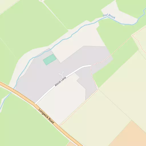
Local Map
⇅
Location Summary
- Alscot is located in Buckinghamshire
- Administrative Area: Buckinghamshire
- Ceremonial County: Buckinghamshire
- Historic County: Buckinghamshire
- Region & Country: South East / England
⇅
Nearby Towns & Cities
- Princes Risborough 1.1 km SSE
- Wendover 7.4 km ENE
- Aylesbury 9.6 km NNE
- Thame 9.8 km W
- Oxford 28.9 km W


⇅
Nearby Localities
- Monks RisboroughDistrict 832 m E
- AskettVillage 1.5 km ENE
- WhiteleafVillage 1.6 km E
- LongwickVillage 1.6 km WNW
- Smokey RowDistrict 2.5 km NE
- SaundertonVillage 2.7 km SSW
- Pitch GreenVillage 2.8 km WSW
- Little KimbleVillage 3.2 km NE
- BledlowVillage 3.4 km WSW
- Loosley RowVillage 4.1 km SSE


⇅
Smaller Settlements
- Meadle 1.4 km N
- Horsenden 1.7 km SSW
- Lower Cadsden 1.9 km ENE
- Owlswick 2.2 km NW
- Great Kimble 2.7 km NE
- Green Hailey 2.8 km ESE
- Holly Green 3.1 km WSW
- Kimble Wick 3.3 km N
- Skittle Green 3.4 km WSW
- Parslow's Hillock 3.5 km SE


⇅
Beaches
- Cotswold Hills Beach77.7 km W
- Hadleigh Ray101.1 km ESE
- Weston Point101.2 km SSW
⇅
Parks
- Balderson's Moor25.1 km E
- Chaulden Meadow23.4 km E
- Merton Field28.4 km W
- The Common29.1 km SSW
⇅
Woods
- Brush Hill Plantation2.2 km ESE
- Giles's Wood2.4 km E
- Roundabout Wood2.2 km SSW
- The Rag Pit1.8 km E
⇅
Hills
- Dial Hill2.7 km NE
- Hemley Hill2.8 km S
- Whiteleaf Hill2.0 km ESE
- Windsor Hill2.3 km ESE

⇅
Lakes
- Biggin Pond7.0 km NNW
- Cross Lane Pond7.2 km SSW
- Deep Pit Pond4.7 km SSE
- Mill Pond3.9 km NE

⇅
Waterfalls
- Neptune Waterfall20.4 km ESE
- The Cascade34.9 km NNW
- Tower Waterfall19.7 km ESE
⇅
Headlands
- Botany Bay Point39.5 km SSE
- Tripcock Ness68.9 km ESE
⇅
Islands
- China Island17.2 km NW
- The Island13.7 km WSW
⇅
Wetlands
- Cock Marsh19.4 km SSE
- Wargrave Marsh24.5 km S
- Ickenham Marsh34.3 km SE
⇅
Health Services
- Stoke Mandeville HospitalHospital 7.7 km NNE
- Thame Community HospitalHospital 9.1 km W
- Cherry Tree Nursing HomeMedical 2.6 km SSW
- Hempton Field Nursing HomeMedical 5.4 km WSW
⇅
Education
- Princes Risborough SchoolSchool 674 m SE
- St Teresa's SchoolSchool 947 m SSE
- Buckinghamshire New UniversityUniversity 9.3 km NNE
⇅
Railway Stations
- Monks Risborough729 m ENE
- Princes Risborough1.7 km SSW
⇅
Bus Stations
- Aylesbury Bus Station9.3 km N
- High Wycombe Bus Station12.6 km SSE
⇅
Coach Stations
- High Wycombe Coachway14.2 km SSE
- Luton Airport Bus and Coach Station35.8 km ENE
⇅
Ferry Terminals
- Hammerton's Pier48.2 km SE
- Hampton Ferry Boathouse48.5 km SE
⇅
Airports
- Wycombe Air Park13.9 km S
- London Oxford Airport35.0 km WNW
⇅
Airfields
- Halton Airfield9.5 km NE
- Chalgrove Airfield18.1 km WSW
⇅
Heliports
- The London Heliport54.1 km ESE
- Magpas Air Ambulance82.2 km NNE
⇅
Harbours
- Chelsea Harbour53.7 km ESE
- Hendy's Quay99.1 km S