
Horsenden
About Horsenden
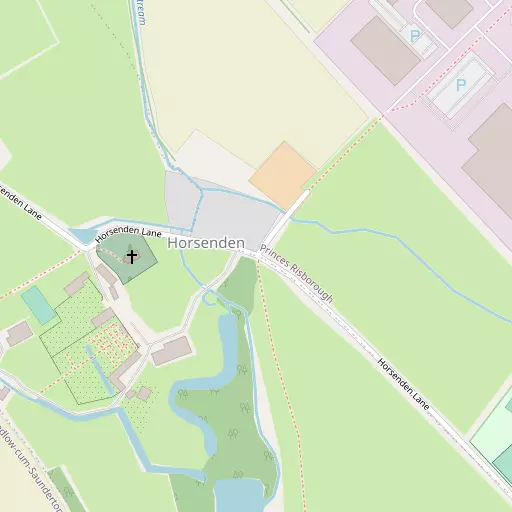
Horsenden sits within Buckinghamshire. Neighbouring places include Saunderton lying 1.0 km South, Pitch Green around 1.7 km West, Bledlow situated 2.1 km West, Longwick just 2.3 km North North West and Monks Risborough around 2.3 km North East. Other countryside places nearby include Alscot, Holly Green, Skittle Green and Meadle.
You may find extra local information by clicking a nearby place.
Data shown here comes from OS, ONS and OSM under open licence, using the latest public sources available.
⇅
Local Map
⇅
Location Summary
- Horsenden is located in Buckinghamshire
- Administrative Area: Buckinghamshire
- Ceremonial County: Buckinghamshire
- Historic County: Buckinghamshire
- Region & Country: South East / England
⇅
Nearby Towns & Cities
- Princes Risborough 1.4 km ENE
- Wendover 8.8 km ENE
- Thame 9.4 km WNW
- Aylesbury 11.2 km NNE
- Oxford 28.2 km W


⇅
Nearby Localities
- SaundertonVillage 1.0 km S
- Pitch GreenVillage 1.7 km W
- BledlowVillage 2.1 km W
- LongwickVillage 2.3 km NNW
- Monks RisboroughDistrict 2.3 km NE
- WhiteleafVillage 2.8 km ENE
- AskettVillage 3.1 km NE
- Loosley RowVillage 3.2 km SE
- HentonVillage 3.2 km W
- Saunderton LeeVillage 3.4 km SSE


⇅
Smaller Settlements
- Alscot 1.7 km NNE
- Holly Green 2.3 km WNW
- Skittle Green 2.3 km W
- Meadle 3.1 km NNE
- Hempton Wainhill 3.1 km WSW
- Forty Green 3.2 km WNW
- Owlswick 3.3 km N
- Green Hailey 3.3 km E
- Parslow's Hillock 3.4 km ESE
- Lower Cadsden 3.4 km NE


⇅
Beaches
- Cotswold Hills Beach76.8 km W
- Weston Point99.5 km SSW
- Weston Shelf99.8 km SSW

⇅
Parks
- Balderson's Moor26.0 km E
- Chaulden Meadow24.3 km E
- Merton Field27.8 km W
- The Common27.4 km SSW
⇅
Woods
- Roundabout Wood533 m S
- The Warren2.5 km SW
- Thickthorne Wood2.9 km SW
- Winchester Wood2.7 km ESE

⇅
Hills
- Hemley Hill1.4 km SSE
- Lodge Hill2.9 km S
- Wain Hill3.0 km SW
- Whiteleaf Hill2.9 km ENE
⇅
Lakes
- Cross Lane Pond5.6 km S
- Deep Pit Pond4.0 km SE
- Mill Pond5.6 km NE
- Wibner Pond7.8 km ESE
⇅
Waterfalls
- Neptune Waterfall20.8 km ESE
- The Cascade36.0 km NNW
- Tower Waterfall20.1 km ESE
⇅
Headlands
- Botany Bay Point38.5 km SSE
- Tripcock Ness69.2 km ESE
⇅
Islands
- China Island17.7 km NW
- The Island12.5 km WSW

⇅
Wetlands
- Cock Marsh18.4 km SSE
- Wargrave Marsh22.9 km S
- Ickenham Marsh34.1 km ESE
⇅
Health Services
- Thame Community HospitalHospital 8.7 km WNW
- Stoke Mandeville HospitalHospital 9.4 km NNE
- Cherry Tree Nursing HomeMedical 1.0 km S
- Hempton Field Nursing HomeMedical 3.9 km WSW
⇅
Education
- St Teresa's SchoolSchool 1.5 km ENE
- Princes Risborough SchoolSchool 1.8 km NE
- Buckinghamshire New UniversityUniversity 10.9 km NNE
⇅
Railway Stations
- Princes Risborough476 m ESE
- Princes Risborough542 m ESE
⇅
Bus Stations
- Aylesbury Bus Station11.0 km NNE
- High Wycombe Bus Station11.7 km SSE
⇅
Coach Stations
- High Wycombe Coachway13.1 km SSE
- Luton Airport Bus and Coach Station37.2 km ENE
⇅
Ferry Terminals
- Hammerton's Pier47.9 km SE
- Hampton Ferry Boathouse48.0 km SE
⇅
Airports
- Wycombe Air Park12.6 km SSE
- London Oxford Airport34.8 km WNW
⇅
Airfields
- Halton Airfield11.1 km NE
- Chalgrove Airfield16.8 km WSW
⇅
Heliports
- The London Heliport54.1 km ESE
- Magpas Air Ambulance84.0 km NNE
⇅
Harbours
- Chelsea Harbour53.6 km ESE
- Hendy's Quay97.6 km S