
Blackdown, Mary Tavy
About Blackdown
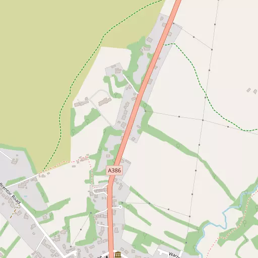
Blackdown is positioned 634 m S from Mary Tavy in Devon. Nearby places include Mary Tavy around 634 m South, North Brentor situated 2.6 km West North West, Peter Tavy situated 2.7 km South South East, Lydford lying 4.9 km North and Lamerton only 6.3 km West South West. Other settlements close by include Horndon, Cudlipptown, Heathfield and Holdstrong.
You might discover something new by clicking a nearby place for more local details.
All place information is taken from OS, ONS and OSM under open licence.
⇅
Local Map
⇅
Location Summary
- Blackdown is a neighbourhood in Mary Tavy
- Administrative Area: Devon
- Ceremonial County: Devon
- Historic County: Devon
- Region & Country: South West / England
⇅
Nearby Towns & Cities
- Parent town: Mary Tavy
- Tavistock 6.0 km SSW
- Okehampton 17.3 km NNE
- Launceston 17.7 km WNW
- Callington 17.8 km SW
- Plymouth 25.7 km S


⇅
Nearby Localities
- Mary TavyVillage 634 m S
- North BrentorVillage 2.6 km WNW
- Peter TavyVillage 2.7 km SSE
- LydfordVillage 4.9 km N
- LamertonVillage 6.3 km WSW
- ChillatonVillage 7.2 km WNW
- WhitchurchDistrict 7.5 km S
- GrenofenVillage 8.5 km S
- LewdownVillage 8.6 km NW
- BridestoweVillage 9.4 km N


⇅
Smaller Settlements
- Horndon 1.7 km E
- Cudlipptown 2.0 km ESE
- Heathfield 3.5 km WSW
- Holdstrong 5.8 km NNW
- Coryton 5.9 km NW
- Quither 6.1 km W
- Vale Down 6.3 km NNE
- Rushford 6.5 km SW
- Merrivale 6.6 km SE
- Longcross 6.8 km W


⇅
Other places with this name
- Blackdown, Dorset 92.0 km ENE
- Blackdown, Warwickshire 260.9 km NE


⇅
Beaches
- Firestone Bay26.8 km S
- Pebble Side26.4 km S
- Reform Beach26.4 km S
⇅
Parks
- Palm Cross Green32.2 km SSE
- Pennsylvania Park44.6 km ENE
- Pleasure Grounds17.1 km NNE
- Summerleaze Down39.7 km NW
⇅
Woods
- Carpenter's Wood856 m NE
- Coad's Wood1.7 km ESE
- Higher Plantation1.6 km NE
- Kirkside Wood1.6 km SE
⇅
Hills
- Boulters Tor2.9 km SE
- Brent Tor3.3 km W
- Gibbet Hill1.1 km N
- Kent's Tor1.4 km ESE
⇅
Lakes
- Old Mill Leat1.9 km WNW
- River Tavy Reservoir1.4 km SE
- Westdown Pool6.3 km NNW
- Wheal Jewell Reservoir2.5 km NE
⇅
Waterfalls
- Broad Falls19.8 km SE
- White Lady Waterfall3.4 km N
- Yealm Steps19.9 km SE
⇅
Headlands
- Pennard's Point18.2 km SSW
- Weir Point19.2 km SSW
⇅
Islands
- Combestone Island18.7 km ESE
- Island of Rocks11.6 km NNE
⇅
Wetlands
- Mistor Marsh7.1 km ESE
- Broad Marsh11.5 km E
- Foxtor Mires14.8 km SE
⇅
Health Services
- Tavistock General HospitalHospital 6.5 km SSW
- Launceston HospitalHospital 17.4 km W
- Blackdown Nursing HomeMedical 130 m NW
- Chollacott Nursing HomeMedical 6.9 km SSW
⇅
Education
- Mary Tavy and Brentor Community Primary SchoolSchool 1.0 km SSE
- Tor View SchoolSchool 3.8 km SSW
- University of St Mark and St JohnUniversity 20.1 km S
⇅
Railway Stations
- Gunnislake11.9 km SW
- Calstock13.2 km SSW
⇅
Bus Stations
- Kingsbridge Bus Station42.7 km SE
- Exeter Bus Station44.0 km ENE
⇅
Coach Stations
- Plymouth Coach Station25.4 km S
- Torquay Coach Station43.4 km ESE
⇅
Ferry Terminals
- Torpoint Ferry Terminal25.7 km SSW
- Barbican Landing Stage26.2 km S
⇅
Airports
- Plymouth City Airport19.8 km S
- Exeter Airport51.8 km ENE
⇅
Airfields
- Eggesford Airfield34.5 km NNE
- Davidstow Airfield35.5 km W
⇅
Heliports
- Lake Heliport48.9 km N
- Hartland Heliport54.3 km NNW
⇅
Harbours
- Weston Mill Lake23.8 km SSW
- Sutton Harbour25.9 km S