
Vale Down
About Vale Down
Vale Down, in Devon, has Lydford lying 1.6 km South West, Bridestowe around 3.5 km North North West, Sourton lying 4.5 km North North East and North Brentor only 6.2 km South West. Other rural places nearby include Shortacombe, Holdstrong, Pool, Combebow and Forda.
You may find out something new or interesting if you click a nearby place to see more local information.
The details shown here use OS, ONS and OSM data provided under open licence.
⇅
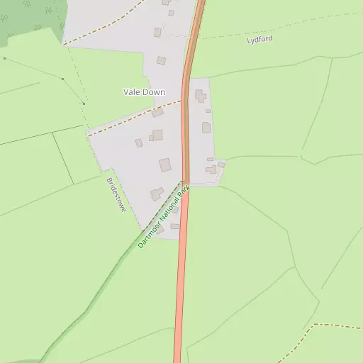
Local Map
⇅
Location Summary
- Vale Down is located in Devon
- Administrative Area: Devon
- Ceremonial County: Devon
- Historic County: Devon
- Region & Country: South West / England
⇅
Nearby Towns & Cities
- Okehampton 11.2 km NNE
- Tavistock 12.3 km SSW
- Chagford 17.7 km E
- Launceston 19.2 km W
- Plymouth 31.9 km S


⇅
Nearby Localities
- LydfordVillage 1.6 km SW
- BridestoweVillage 3.5 km NNW
- SourtonVillage 4.5 km NNE
- North BrentorVillage 6.2 km SW
- BlackdownDistrict 6.3 km SSW
- Mary TavyVillage 6.9 km SSW
- LewdownVillage 7.6 km W
- Bratton ClovellyVillage 8.3 km NW
- Peter TavyVillage 8.5 km S
- StowfordVillage 9.1 km W


⇅
Smaller Settlements
- Shortacombe 726 m N
- Holdstrong 3.8 km W
- Pool 4.1 km N
- Combebow 4.3 km WNW
- Forda 4.8 km N
- Lobhillcross 5.8 km W
- Horndon 6.0 km S
- Lewtrenchard 6.7 km W
- Cudlipptown 7.0 km S
- Coryton 7.1 km WSW


⇅
Beaches
- Firestone Bay33.0 km S
- Pebble Side32.6 km S
- Reform Beach32.6 km S
⇅
Parks
- Palm Cross Green36.7 km SSE
- Pennsylvania Park41.1 km ENE
- Pleasure Grounds11.1 km NE
- Summerleaze Down37.6 km WNW


⇅
Woods
- Beara Wood2.2 km NW
- Blackabroom Plantation1.1 km N
- Eastern Cleave Wood2.1 km SW
- Ingo Plantation1.7 km SSW
⇅
Hills
- Arms Tor1.8 km E
- Brat Tor1.6 km ESE
- Doe Tor2.2 km ESE
- Great Nodden2.1 km NE

⇅
Lakes
- Alder Lake5.0 km WNW
- Meldon Reservoir6.1 km NE
- Westdown Pool4.3 km W
- Wheal Jewell Reservoir4.4 km S
⇅
Waterfalls
- Broad Falls22.9 km SE
- White Lady Waterfall3.4 km SW
- Yealm Steps24.2 km SSE

⇅
Headlands
- Pennard's Point24.5 km SSW
- Weir Point25.5 km SSW
⇅
Islands
- Combestone Island20.3 km SE
- Island of Rocks5.5 km NE
⇅
Wetlands
- Mistor Marsh9.9 km SSE
- Broad Marsh10.1 km ESE
- Taw Marsh10.9 km ENE
⇅
Health Services
- Tavistock General HospitalHospital 12.8 km SSW
- Launceston HospitalHospital 19.2 km W
- Blackdown Nursing HomeMedical 6.2 km SSW
- Chollacott Nursing HomeMedical 13.1 km SSW
⇅
Education
- Lydford Primary SchoolSchool 1.3 km SW
- Bridestowe Primary SchoolSchool 3.4 km NNW
- University of St Mark and St JohnUniversity 26.1 km S
⇅
Railway Stations
- Meldon Viaduct8.0 km NNE
- Okehampton10.8 km NE
⇅
Bus Stations
- Exeter Bus Station40.7 km ENE
- Kingsbridge Bus Station46.9 km SSE
⇅
Coach Stations
- Plymouth Coach Station31.6 km S
- Torquay Coach Station44.0 km ESE
⇅
Ferry Terminals
- Torpoint Ferry Terminal31.9 km SSW
- Barbican Landing Stage32.4 km S
⇅
Airports
- Plymouth City Airport25.8 km S
- Exeter Airport48.5 km E
⇅
Airfields
- Eggesford Airfield28.5 km NE
- Eaglescott Airfield31.2 km NNE
⇅
Heliports
- Lake Heliport43.5 km NNW
- Hartland Heliport50.4 km NW
⇅
Harbours
- Weston Mill Lake30.1 km SSW
- Sutton Harbour32.0 km S