
Brickhill, Bedford
About Brickhill
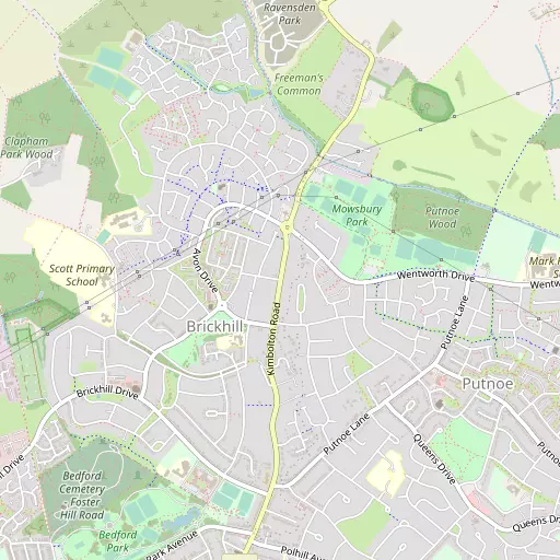
Brickhill sits 869 m SSE of Bedford in Bedford. Neighbouring places include Putnoe lying 869 m South South East, Woodside just 1.1 km East South East, Cleat Hill around 1.2 km North North East, Renhold just 1.9 km North East and Salph End around 2.0 km East. Other settlements close by include Wood End, Sevick End, Harrowden and East End.
You may notice something interesting if you explore one of the nearby places.
The place data here is drawn from OS, ONS and OSM under open licence.
⇅
Local Map
⇅
Location Summary
⇅
Nearby Towns & Cities
⇅
Nearby Localities
⇅
Smaller Settlements
⇅
Other places with this name
- Brickhill, Hampshire
⇅
Beaches
- Hadleigh Ray
- Mill Beach
- Snettisham Beach
⇅
Parks
- Buckwell Green
- Elfield Park
- New Pasture
- The Green
⇅
Woods
- Clapham Park
- Claphampark Wood
- Parkwood
- Putnoe Wood
⇅
Hills
- Castle Hill
- Mowsbury Hill
- Oakley Hill
- Summerhouse Hill
⇅
Lakes
- Bromham Lake
- New Cut
- Priory Marina
- Riverside Pond
⇅
Waterfalls
- Neptune Waterfall
- The Cascade
- Tower Waterfall
⇅
Headlands
- Botany Bay Point
- Tripcock Ness
⇅
Islands
- Longholme Island
- Rink Islands
⇅
Wetlands
- Summer Leys
- Fowlmere
- Ouse Fen
⇅
Health Services
- Bedford Hospital South Wing
- Manor Hospital
- The Airedale Nursing Home
- Crossways Nursing Home
⇅
Education
- Brickhill Primary School
- St Thomas More Catholic Teaching School
- Polhill Campus
⇅
Train Stations
- Bedford
- Bedford St Johns
⇅
Bus Stations
- Huntingdon Bus Station
- Bletchley Bus Station
⇅
Coach Stations
- Milton Keynes Coachway
- Luton Airport Bus and Coach Station
⇅
Ferry Terminals
- Embankment Pier
- Blackfriars Pier
⇅
Airports
- London Luton Airport
- Cambridge City Airport
⇅
Airfields
- Sackfield Airfield
⇅
Heliports
- Magpas Air Ambulance
⇅
Harbours
- Chelsea Harbour
- Farndon Harbour