
East End
About East End
East End sits within Bedford. Nearby places include Wilden lying 577 m West South West, Ravensden lying 2.6 km West South West, Renhold only 2.8 km South South West, Workhouse End just 2.9 km South and Chapel End situated 3.0 km North. Other rural areas close to here include Duck's Cross, Sevick End, Channel's End and Rootham's Green.
You may notice something interesting if you explore one of the nearby places.
The place data here is drawn from OS, ONS and OSM under open licence.
⇅
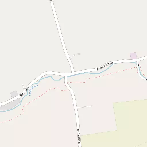
Local Map
⇅
Location Summary
⇅
Nearby Towns & Cities


⇅
Nearby Localities
- WildenVillage 577 m WSW
- RavensdenVillage 2.6 km WSW
- RenholdVillage 2.8 km SSW
- Workhouse EndVillage 2.9 km S
- Chapel EndDistrict 3.0 km N
- Green EndDistrict 3.3 km SE
- RenholdVillage 3.4 km WSW
- Salph EndVillage 3.5 km SW
- ColmworthVillage 3.7 km N
- Great BarfordVillage 3.8 km SE


⇅
Smaller Settlements
- Duck's Cross 1.4 km NE
- Sevick End 1.5 km SW
- Channel's End 1.7 km NNE
- Rootham's Green 2.2 km N
- Mill End 2.3 km NNE
- Colesden 2.7 km ENE
- Wood End 4.3 km W
- Honeydon 4.7 km NE
- Wood End 5.0 km N
- Cross End 5.2 km NW


⇅
Other places with this name
Closest
- East End, Central Bedfordshire18.6 km SW
- East End, Milton Keynes 19.1 km WSW
- East End, Cambridgeshire33.1 km NE
- East End, Hertfordshire 44.2 km SE
- East End, Cambridgeshire58.0 km ENE
Furthest away
- East End, Dorset 191.9 km SW
- East End, North Somerset186.3 km WSW
- East End, Somerset182.8 km WSW
- East End, North Somerset182.6 km WSW
- East End, Somerset179.2 km SW
⇅
Beaches
- Mill Beach91.3 km ESE
- Snettisham Beach94.2 km NE
- Snettisham Scalp95.1 km NE

⇅
Parks
- Buckwell Green25.2 km WNW
- New Pasture21.2 km NE
- The Green28.2 km WSW
- Wimpole Park23.4 km E


⇅
Woods
- Great Early Grove2.3 km SSW
- Hook Spinneys2.6 km NW
- Lady Wood2.5 km E
- Little Early Grove2.1 km SW
⇅
Hills
- Castle Hill7.5 km SW
- Mowsbury Hill4.2 km WSW
- Round Hill4.5 km E
- Summerhouse Hill6.0 km SSW
⇅
Lakes
- Navigation Channel6.4 km SSW
- New Cut6.4 km SSW
- Riverside Pond5.4 km SSW
- Seabrook Lake3.4 km N
⇅
Waterfalls
- Neptune Waterfall57.5 km SSW
- The Cascade46.3 km WSW
- Tower Waterfall57.3 km SSW
⇅
Headlands
- Botany Bay Point87.1 km S
- Tripcock Ness82.0 km SSE

⇅
Islands
- Longholme Island7.1 km SW
- Rink Islands7.6 km SW
⇅
Wetlands
- Summer Leys23.2 km WNW
- Fowlmere31.9 km ESE
- Ouse Fen32.4 km ENE
⇅
Health Services
- Bedford Hospital South WingHospital 8.5 km SW
- Manor HospitalHospital 10.0 km WSW
- Crossways Nursing HomeMedical 3.9 km SW
- The Airedale Nursing HomeMedical 6.3 km SW
⇅
Education
- Wilden Voluntary Aided Primary SchoolSchool 748 m W
- Cambian Walnut Tree Lodge SchoolSchool 1.7 km WSW
- Polhill CampusUniversity 5.9 km SW
⇅
Railway Stations
- Bedford8.2 km SW
- Bedford St Johns8.2 km SW
⇅
Bus Stations
- Huntingdon Bus Station21.2 km NE
- Royston Bus Station29.4 km ESE
⇅
Coach Stations
- Milton Keynes Coachway25.6 km SW
- Luton Airport Bus and Coach Station34.0 km S
⇅
Ferry Terminals
- Blackfriars Pier77.4 km SSE
- Embankment Pier77.5 km SSE
⇅
Airports
- London Luton Airport34.2 km S
- Cambridge City Airport38.5 km E
⇅
Airfields
- Sackfield Airfield10.9 km NW
- Biggleswade Airfield12.0 km SSE
⇅
Heliports
- Magpas Air Ambulance23.5 km NNE
- The Egerton-Smith Centre38.2 km E
⇅
Harbours
- Chelsea Harbour80.1 km S
- Farndon Harbour102.6 km NNW
