
Brockhall
About Brockhall
Brockhall lies within West Northamptonshire. Neighbouring places include Whilton around 2.1 km North, Flore situated 2.6 km South South East, Little Brington around 2.8 km East North East and Dodford just 2.9 km South West. Other places in the surrounding countryside include Muscott, Stowehill, Nobottle, Upper Heyford and Murcott.
You might discover something new by clicking a nearby place for more local details.
The information presented here is derived from OS, ONS and OSM under open licence.
⇅
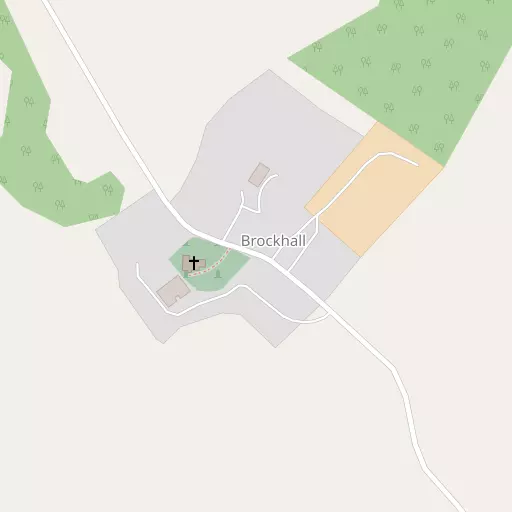
Local Map
⇅
Location Summary
- Brockhall is located in West Northamptonshire
- Administrative Area: West Northamptonshire
- Ceremonial County: West Northamptonshire
- Historic County: West Northamptonshire
- Region & Country: East Midlands / England
⇅
Nearby Towns & Cities
- Daventry 5.9 km W
- Northampton 12.4 km E
- Towcester 15.2 km SSE
- Rugby 18.0 km NW
- Milton Keynes 32.4 km SE


⇅
Nearby Localities
- WhiltonVillage 2.1 km N
- FloreVillage 2.6 km SSE
- Little BringtonVillage 2.8 km ENE
- DodfordVillage 2.9 km SW
- NortonVillage 3.3 km WNW
- Weedon BecVillage 3.4 km S
- Long Buckby WharfVillage 3.5 km NW
- Lower WeedonDistrict 3.7 km S
- Upper WeedonDistrict 4.0 km SSW
- Great BringtonVillage 4.0 km NE


⇅
Smaller Settlements
- Muscott 981 m NW
- Stowehill 3.9 km SSE
- Nobottle 4.1 km E
- Upper Heyford 4.3 km SE
- Murcott 5.2 km NNW
- Little Everdon 6.1 km SW
- Holdenby 8.2 km NE
- Fawsley 9.5 km SW
- Teeton 9.8 km NE
- Little Preston 9.8 km SSW

⇅
Beaches
- Cotswold Hills Beach90.0 km SW
- Snettisham Beach122.7 km NE
- Snettisham Scalp123.1 km NE
⇅
Parks
- Bilton Common18.4 km NW
- Foot Meadow11.5 km ESE
- The Green7.3 km ESE
- The Green8.1 km WSW


⇅
Woods
- Brooks's Plantation686 m S
- Burton Wood523 m SSW
- Gazewell Spinney470 m N
- Rectory Spinney291 m NE
⇅
Hills
- Gawburrow Hill3.3 km NE
- Thornburrow Hill3.7 km NE
- Waydale Hill2.1 km E
- Whilton Hill1.8 km N
⇅
Lakes
- Daventry Reservoir5.4 km WNW
- Garden Stew5.4 km ENE
- Old Mill Race1.3 km NW
- Old Mill Stream983 m WNW
⇅
Waterfalls
- Neptune Waterfall73.7 km SSE
- The Cascade26.1 km S
- Tower Waterfall73.1 km SSE
⇅
Headlands
- Botany Bay Point99.8 km SSE
- Tripcock Ness115.5 km SE
⇅
Islands
- Millholme Island31.7 km ESE
- Monkey Island26.0 km S
⇅
Wetlands
- Summer Leys25.1 km E
- Welches Meadow30.7 km W
- Wyken Slough34.1 km NW
⇅
Health Services
- Danetre HospitalHospital 6.0 km W
- Berrywood HospitalHospital 7.8 km E
- Brownlands Nursing HomeMedical 6.0 km W
- Wheatsheaf Court Nursing HomeMedical 6.1 km W
⇅
Education
- Flore Church of England Primary SchoolSchool 2.8 km SSE
- Brington Primary SchoolSchool 3.2 km ENE
- University of Northampton Waterside CampusUniversity 13.1 km ESE
⇅
Railway Stations
- Long Buckby4.1 km NNW
- Boughton10.7 km ENE
⇅
Bus Stations
- Daventry Bus Station5.9 km W
- North Gate Bus Station12.1 km E
⇅
Coach Stations
- Milton Keynes Coachway34.1 km SE
- Shakespeare's Birthplace Coach Terminal43.9 km W
⇅
Ferry Terminals
- Normanton Chain Ferry61.2 km N
- Hammerton's Pier104.3 km SSE
⇅
Airports
- Coventry Airport30.4 km WNW
- Wellesbourne Mountford Airfield37.4 km W
⇅
Airfields
- Sywell Aerodrome19.9 km ENE
- Turweston Aerodrome24.4 km S
⇅
Heliports
- Magpas Air Ambulance57.6 km ENE
- Nottingham Heliport64.6 km N
⇅
Harbours
- Farndon Harbour90.8 km N
- Chelsea Harbour106.5 km SE