
Chenson
About Chenson
Chenson, in Devon, has Nymet Rowland around 1.7 km South East, Coldridge only 2.0 km South South West, Chawleigh situated 2.9 km North North East and Lapford only 3.2 km East South East. Other rural localities include Kelland Court, Brushford, Filleigh, West Leigh and East Leigh.
You may notice something interesting if you explore one of the nearby places.
All information is drawn from OS, ONS and OSM under open licence, reflecting the best available public data.
⇅
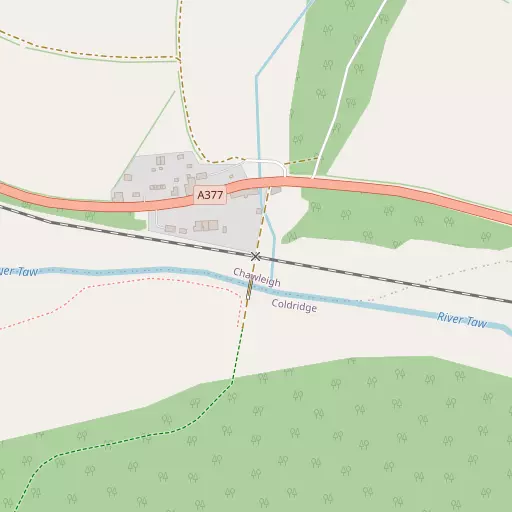
Local Map
⇅
Location Summary
- Chenson is located in Devon
- Administrative Area: Devon
- Ceremonial County: Devon
- Historic County: Devon
- Region & Country: South West / England
⇅
Nearby Towns & Cities
- North Tawton 8.7 km SSW
- Crediton 15.9 km SE
- South Molton 16.4 km N
- Okehampton 18.4 km SW
- Exeter 27.5 km SE


⇅
Nearby Localities
- Nymet RowlandVillage 1.7 km SE
- ColdridgeVillage 2.0 km SSW
- ChawleighVillage 2.9 km NNE
- LapfordVillage 3.2 km ESE
- WembworthyVillage 4.1 km W
- ChulmleighVillage 4.9 km NNW
- Zeal MonachorumVillage 5.8 km SSE
- Down St MaryVillage 6.5 km SE
- Morchard RoadVillage 6.8 km SE
- Morchard BishopVillage 7.0 km ESE


⇅
Smaller Settlements
- Kelland Court 3.2 km SE
- Brushford 3.3 km SW
- Filleigh 4.1 km ENE
- West Leigh 4.3 km SSW
- East Leigh 4.3 km S
- Eastington 4.4 km E
- Leigh Cross 4.8 km S
- Bridge Reeve 5.5 km NW
- Ellicombe 6.1 km SE
- Weeke 6.8 km ESE


⇅
Beaches
- Horsey Ridge32.6 km NW
- Instow Beach31.4 km NW
- Westward Ho! Beach33.8 km NW
⇅
Parks
- Pennsylvania Park27.2 km ESE
- Pleasure Grounds18.5 km SW
- The Lawn41.8 km SE
- The Warren41.4 km NNW
⇅
Woods
- Chenson Wood921 m E
- Churchpath Wood610 m NNE
- Fox Covert790 m NW
- Wiseland Wood493 m SE
⇅
Hills
- Bransgrove Hill4.9 km W
- Bude Hill4.8 km WSW
- Colt's Hill4.8 km ESE
- Cornbury Hill5.0 km SE

⇅
Lakes
- Balman's Pool12.3 km NNW
- Claypitt's Water6.9 km WNW
- Combe Fish Ponds8.3 km SSE
- Junction Pool9.0 km NNW

⇅
Waterfalls
- Becka Falls30.0 km SSE
- Horseshoe Falls39.1 km S
- White Lady Waterfall32.9 km SW
⇅
Headlands
- Cockington Head34.5 km WNW
- North Cleave39.4 km N
⇅
Islands
- Horsey Island32.9 km NW
- Island of Rocks24.1 km SW
⇅
Wetlands
- Roach Marsh3.7 km NW
- Long Marsh4.3 km NNE
- Trick's Marsh14.4 km N
⇅
Health Services
- Crediton HospitalHospital 15.0 km SE
- South Molton Community HospitalHospital 16.2 km N
- Eastleigh Care HomeMedical 16.3 km N
- Hatherleigh Nursing HomeMedical 17.6 km WSW
⇅
Education
- Lapford Community Primary SchoolSchool 3.4 km ESE
- Chulmleigh Primary SchoolSchool 5.3 km NNW
- Duryard Halls of ResidenceUniversity 25.7 km SE
⇅
Railway Stations
- Eggesford2.8 km NW
- Lapford2.9 km ESE
⇅
Bus Stations
- Barnstaple Bus Station27.4 km NNW
- Exeter Bus Station27.8 km SE
⇅
Coach Stations
- Torquay Coach Station49.2 km SSE
- Plymouth Coach Station59.2 km SSW
⇅
Ferry Terminals
- Starcross Pier39.1 km SE
- Greenway Quay57.2 km SSE
⇅
Airports
- Exeter Airport34.0 km ESE
- Plymouth City Airport53.1 km SSW
⇅
Airfields
- Eggesford Airfield1.4 km WSW
- Eaglescott Airfield11.8 km WNW
⇅
Heliports
- Lake Heliport33.6 km WNW
- Hartland Heliport49.9 km WNW
⇅
Harbours
- Lympstone Boat Shelter38.2 km SE
- Lynmouth Harbour40.1 km N