
Cottesbrooke
About Cottesbrooke
Cottesbrooke is in West Northamptonshire. Nearby places include Creaton just 1.6 km South South West, Hollowell around 2.5 km South West, Spratton only 3.3 km South and Guilsborough lying 3.8 km West. Other rural communities nearby include Queen's Row, Teeton, Coton, Holdenby and Foxhall.
You may find extra local information by clicking a nearby place.
All information is drawn from OS, ONS and OSM under open licence, reflecting the best available public data.
⇅
Local Map
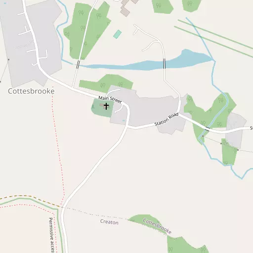
⇅
Location Summary
- Cottesbrooke is located in West Northamptonshire
- Administrative Area: West Northamptonshire
- Ceremonial County: West Northamptonshire
- Historic County: West Northamptonshire
- Region & Country: East Midlands / England
⇅
Nearby Towns & Cities
- Desborough 13.4 km NE
- Northampton 13.6 km SSE
- Market Harborough 14.1 km N
- Kettering 16.3 km ENE
- Leicester 33.3 km NNW


⇅
Nearby Localities
- CreatonVillage 1.6 km SSW
- HollowellVillage 2.5 km SW
- SprattonVillage 3.3 km S
- GuilsboroughVillage 3.8 km W
- HaselbechVillage 4.0 km N
- Hanging HoughtonVillage 4.2 km E
- BrixworthVillage 4.5 km SE
- ThornbyVillage 4.5 km WNW
- NasebyVillage 5.0 km NNW
- LamportVillage 5.1 km ENE


⇅
Smaller Settlements
- Queen's Row 3.2 km S
- Teeton 3.5 km SSW
- Coton 4.1 km WSW
- Holdenby 5.7 km SSW
- Foxhall 8.3 km ENE
- Winwick 8.5 km W
- Elkington 9.4 km WNW
- Sulby 10.3 km NNW
- Thorpe Underwood 10.8 km NE
- Murcott 10.9 km WSW

⇅
Beaches
- Cotswold Hills Beach103.1 km SW
- Snettisham Beach110.4 km ENE
- Snettisham Scalp110.6 km ENE
⇅
Parks
- Buckwell Green18.3 km ESE
- Foot Meadow13.6 km SSE
- The Green14.2 km S
- The Green20.8 km SW

⇅
Woods
- Park Spinney797 m NNE
- Pole Spinney1.0 km NNW
- Square Hedge Spinney1.2 km WNW
- The Shrubbery919 m N

⇅
Hills
- Bickle Hill1.6 km SSW
- Clint Hill3.6 km E
- Hoe Hill5.8 km SSE
- Hoppin Hill4.6 km NE
⇅
Lakes
- Hollowell Reservoir2.4 km WSW
- River Nene Brampton Branch3.4 km ENE
- Spratton Brook (Hollowell Arm)3.5 km WNW
- Spratton Brook (Ravensthorpe Arm)4.2 km SW
⇅
Waterfalls
- Neptune Waterfall80.1 km SSE
- The Cascade36.6 km S
- Tower Waterfall79.6 km SSE
⇅
Headlands
- Botany Bay Point107.7 km SSE
- Tripcock Ness118.4 km SE
⇅
Islands
- Millholme Island29.3 km SE
- The Islands24.2 km NNW
⇅
Wetlands
- Summer Leys20.0 km ESE
- Lucas Marsh27.8 km NNW
- Wyken Slough36.2 km WNW
⇅
Health Services
- Berrywood HospitalHospital 11.9 km S
- John Greenwood Shipman CentreHospital 12.6 km SE
- Pytchley Court Nursing HomeMedical 4.9 km SE
- Sibbertoft ManorMedical 9.6 km NNW
⇅
Education
- Spratton Hall SchoolSchool 3.0 km SSE
- Spratton Church of England Primary SchoolSchool 3.2 km SSE
- Northampton School of PodiatryUniversity 14.2 km SSE
⇅
Railway Stations
- Pitsford and Brampton7.1 km SSE
- Boughton8.4 km SSE
⇅
Bus Stations
- North Gate Bus Station13.5 km SSE
- Daventry Bus Station17.6 km SW
⇅
Coach Stations
- Milton Keynes Coachway37.6 km SSE
- Shakespeare's Birthplace Coach Terminal54.2 km WSW
⇅
Ferry Terminals
- Normanton Chain Ferry53.0 km NNW
- Hammerton's Pier110.1 km SSE
⇅
Airports
- Coventry Airport35.7 km W
- Wellesbourne Mountford Airfield48.0 km WSW
⇅
Airfields
- Sywell Aerodrome12.5 km ESE
- Leicester Airport28.3 km N
⇅
Heliports
- Magpas Air Ambulance48.1 km E
- Nottingham Heliport54.1 km N
⇅
Harbours
- Farndon Harbour79.2 km N
- Chelsea Harbour111.3 km SSE