
Countisbury
About Countisbury
Countisbury lies within Devon. Local places nearby include Lynmouth just 2.4 km West, Barbrook lying 3.8 km West South West, Parracombe lying 9.1 km West South West and Simonsbath only 10.7 km South South East. Other places in the surrounding countryside include Wilsham, Rockford, Alderford, Brendon and West Lyn.
You may find extra local information by clicking a nearby place.
This page uses OS, ONS and OSM data supplied under open licence.
⇅
Local Map
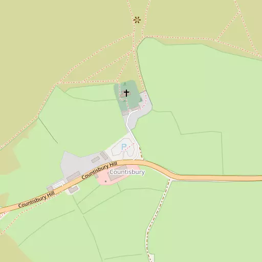
⇅
Location Summary
- Countisbury is located in Devon
- Administrative Area: Devon
- Ceremonial County: Devon
- Historic County: Devon
- Region & Country: South West / England
⇅
Nearby Towns & Cities
- Lynton 2.7 km W
- Minehead 22.3 km E
- Ilfracombe 23.2 km W
- South Molton 24.0 km S
- Abertawe 44.2 km NNW


⇅
Nearby Localities
- LynmouthVillage 2.4 km W
- BarbrookVillage 3.8 km WSW
- ParracombeVillage 9.1 km WSW
- SimonsbathVillage 10.7 km SSE
- Porlock WeirVillage 11.9 km E
- PorlockVillage 14.2 km E
- ExfordVillage 15.4 km SE
- Bratton FlemingVillage 16.0 km SW
- AllerfordVillage 16.0 km E
- BrayfordVillage 16.0 km SSW


⇅
Smaller Settlements

⇅
Beaches
- Eastern Beach2.1 km W
- Sillery Sands669 m WNW
- Western Beach2.6 km W

⇅
Parks
- Black Pill Burrows43.3 km NNW
- Cooper's Fields50.8 km ENE
- Lock's Common28.4 km N
- The Warren19.2 km W


⇅
Woods
- Horner's Neck Wood999 m SSW
- Scrip Wood965 m SE
- Trilly Wood754 m S
- Wester Wood857 m SW
⇅
Hills
- Butter Hill388 m NNE
- Kipscombe Hill1.8 km E
- Trilly332 m SSE
- Wind Hill865 m WSW

⇅
Lakes
- Bray Reservoir9.1 km SSW
- Long Pool1.4 km SSE
- Pinkworthy Pond7.8 km SSW
- Simonsbath Pool10.8 km SSE
⇅
Waterfalls
- Aberdulais Falls49.9 km N
- Berw-ddu56.5 km NNE
- Melin Court Waterfall52.5 km N
⇅
Headlands
- Foreland Point1.6 km NNE
- The Foreland1.3 km NNE
⇅
Islands
- Burrow Nose19.3 km W
- Sexton's Burrow19.6 km W
⇅
Wetlands
- Point Perilous1.9 km W
- Ruddy Ball3.0 km W
- Gore Point11.2 km E
⇅
Health Services
- Ilfracombe Tyrrell HospitalHospital 23.1 km W
- Minehead Community HospitalHospital 23.5 km E
- Edenmore Nursing HomeMedical 22.8 km W
- Winsor Nursing HomeMedical 22.8 km E
⇅
Education
- Lynton Church of England Primary SchoolSchool 2.7 km W
- Parracombe Church of England Primary SchoolSchool 9.0 km WSW
- PetrocUniversity 26.1 km SW
⇅
Railway Stations
- Woody Bay7.3 km WSW
- Killington Lane8.5 km WSW
⇅
Bus Stations
- Barnstaple Bus Station25.0 km SW
- Gorsaf Fysiau Pen-y-Bont ar Ogwr34.1 km NNE
⇅
Coach Stations
- Torquay Coach Station86.3 km SSE
- Plymouth Coach Station98.7 km SSW
⇅
Ferry Terminals
- Newport Transporter Bridge West67.5 km NE
- Newport Transporter Bridge East67.7 km NE

⇅
Airports
- Cardiff Airport36.3 km ENE
- Swansea Airport45.3 km NNW
⇅
Airfields
- Chivenor Airfield29.5 km WSW
- Maes Awyr Sain Tathan31.7 km NE
⇅
Heliports
- Lake Heliport38.8 km SW
- Cardiff City Heliport52.6 km ENE
⇅
Harbours
- Lynmouth Harbour2.5 km W
- Watchet Harbour33.0 km E