
Dartmeet
About Dartmeet
Dartmeet sits within Devon. Among the nearby places are Holne just 5.0 km South East, Holne Turn situated 7.8 km East South East, Princetown just 8.1 km West and Higher Town situated 8.9 km South East. Other countryside places nearby include Hexworthy, Ponsworthy, Poundsgate, Leusdon and Lower Town.
You might learn something new by clicking through to a nearby place.
These details are compiled from OS, ONS and OSM data released under open licence.
⇅
Local Map
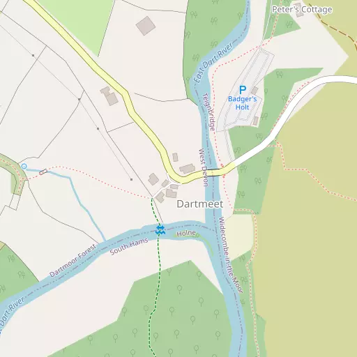
⇅
Location Summary
- Dartmeet is located in Devon
- Administrative Area: Devon
- Ceremonial County: Devon
- Historic County: Devon
- Region & Country: South West / England
⇅
Nearby Towns & Cities
- Ashburton 9.1 km ESE
- Buckfastleigh 9.8 km SE
- Chagford 14.6 km N
- Moretonhampstead 15.3 km NNE
- Plymouth 26.9 km SW


⇅
Nearby Localities
- HolneVillage 5.0 km SE
- Holne TurnDistrict 7.8 km ESE
- PrincetownVillage 8.1 km W
- Higher TownDistrict 8.9 km SE
- BuckfastVillage 9.1 km SE
- GlebelandsDistrict 9.1 km SE
- Lower TownDistrict 9.5 km SE
- Lower DeanDistrict 10.3 km SE
- DeanDistrict 10.3 km SE
- Haytor ValeVillage 10.6 km ENE


⇅
Smaller Settlements
- Hexworthy 1.7 km WSW
- Ponsworthy 2.9 km ENE
- Poundsgate 3.6 km ESE
- Leusdon 3.7 km E
- Lower Town 4.0 km E
- Bellever 4.5 km NNW
- Michelcombe 4.9 km SSE
- Buckland in the Moor 4.9 km E
- Pizwell 5.3 km N
- Scorriton 5.7 km SE


⇅
Beaches
- Hollicombe Beach25.2 km ESE
- Livermead Sands25.4 km ESE
- Preston Sands25.2 km ESE
⇅
Parks
- Palm Cross Green21.5 km S
- Pennsylvania Park33.1 km NE
- Pleasure Grounds22.9 km NNW
- The Lawn29.1 km E


⇅
Woods
- Brake Plantation1.1 km N
- Clay Brake895 m SW
- Combestone Wood776 m S
- Snider Park Plantation968 m WNW

⇅
Hills
- Combestone Tor1.3 km S
- Corndon Down1.7 km NE
- Mel Tor2.3 km ESE
- Yar Tor1.0 km NE
⇅
Lakes
- Blackpool1.8 km SE
- Mel Pool2.5 km ESE
- Sharrah Pool3.0 km ESE
- Venford Reservoir2.6 km SSE
⇅
Waterfalls
- Broad Falls6.4 km SSW
- Horseshoe Falls4.8 km ESE
- Yealm Steps10.9 km SSW

⇅
Headlands
- Ashprington Point23.0 km SE
- Sharpham Point22.1 km SE
⇅
Islands
- Bellpool Island3.3 km ESE
- Combestone Island911 m SSE
⇅
Wetlands
- Hockinston Marsh2.7 km ESE
- Sharrah Pool Marsh3.1 km ESE
- Newbridge Marsh4.5 km ESE
⇅
Health Services
- Moretonhampstead HospitalHospital 15.4 km NNE
- Lee Mill HospitalHospital 18.1 km SSW
- Bramble DownMedical 15.4 km ESE
- Hart Care Nursing and Residential HomeMedical 16.8 km WSW
⇅
Education
- Princetown Community Primary SchoolSchool 8.2 km W
- St Mary's Roman Catholic Primary SchoolSchool 9.1 km SE
- Schumacher CollegeUniversity 15.5 km SE
⇅
Railway Stations
- Buckfastleigh10.2 km SE
- Staverton14.6 km SE
⇅
Bus Stations
- Kingsbridge Bus Station29.8 km SSE
- Exeter Bus Station32.1 km NE
⇅
Coach Stations
- Torquay Coach Station25.3 km ESE
- Plymouth Coach Station26.8 km SW
⇅
Ferry Terminals
- Barbican Landing Stage26.9 km SW
- Greenway Quay27.0 km SE
⇅
Airports
- Plymouth City Airport21.2 km SW
- Exeter Airport39.0 km ENE
⇅
Airfields
- Bolt Head Airfield35.9 km S
- Eggesford Airfield36.0 km N
⇅
Heliports
- Lake Heliport60.5 km NNW
- Hartland Heliport69.5 km NW

⇅
Harbours
- Paignton Harbour25.8 km ESE
- New Harbour26.4 km ESE