
Hexworthy
About Hexworthy
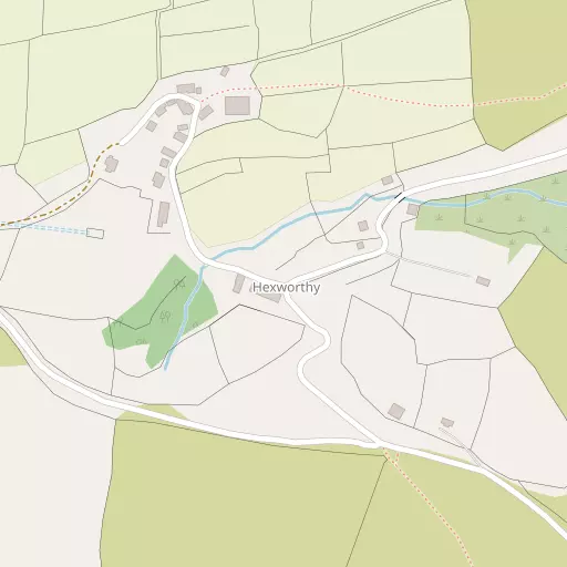
Hexworthy lies within Devon. Nearby places include Holne situated 5.9 km East South East, Princetown just 6.6 km West, Holne Turn just 9.2 km East South East, Higher Town only 9.8 km South East and Glebelands only 10.0 km South East. Other nearby hamlets and settlements include Dartmeet, Whiteworks, Ponsworthy and Bellever.
You might learn something new by clicking through to a nearby place.
This information is based on OS, ONS and OSM data released under open licence.
⇅
Local Map
⇅
Location Summary
- Hexworthy is located in Devon
- Administrative Area: Devon
- Ceremonial County: Devon
- Historic County: Devon
- Region & Country: South West / England
⇅
Nearby Towns & Cities
⇅
Nearby Localities
⇅
Smaller Settlements
⇅
Beaches
- Meadowsfoot Beach
- Mount Batten
- Wonwell Beach
⇅
Parks
- Palm Cross Green
- Pennsylvania Park
- Pleasure Grounds
- The Lawn
⇅
Woods
- Clay Brake
- Combestone Wood
- Little Stennents Plantation
- Snider Park Plantation
⇅
Hills
- Combestone Tor
- Down Ridge
- Ter Hill
- Yar Tor
⇅
Lakes
- Blackpool
- Mel Pool
- Sharrah Pool
- Venford Reservoir
⇅
Waterfalls
- Broad Falls
- Horseshoe Falls
- Yealm Steps
⇅
Headlands
- Pennard's Point
- Sharpham Point
⇅
Islands
- Bellpool Island
- Combestone Island
⇅
Wetlands
- Hockinston Marsh
- Foxtor Mires
- Sharrah Pool Marsh
⇅
Health Services
- Moretonhampstead Hospital
- Lee Mill Hospital
- Hart Care Nursing and Residential Home
- Beaconville
⇅
Education
- Princetown Community Primary School
- St Mary's Roman Catholic Primary School
- Schumacher College
⇅
Train Stations
- Buckfastleigh
- Staverton
⇅
Bus Stations
- Kingsbridge Bus Station
- Exeter Bus Station
⇅
Coach Stations
- Plymouth Coach Station
- Torquay Coach Station
⇅
Ferry Terminals
- Barbican Landing Stage
- Mount Batten Passenger Ferry Terminal
⇅
Airports
- Plymouth City Airport
- Exeter Airport
⇅
Airfields
- Bolt Head Airfield
⇅
Heliports
- Lake Heliport
⇅
Harbours
- Sutton Harbour
- Weston Mill Lake