
East End, Isleham
About East End
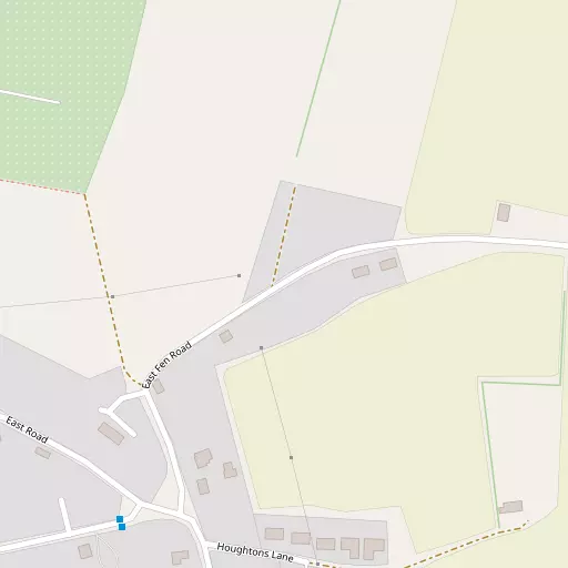
East End is positioned 476 m NNW from Isleham in Cambridgeshire. Nearby places include Waterside situated 476 m North North West, Isleham just 796 m West South West, Little London just 1.1 km West South West, West Row lying 2.5 km East North East and Freckenham around 3.1 km South South East. Other places nearby include Badlingham, Kenny Hill, Broad Hill and Wilde Street.
You may find extra local information by clicking a nearby place.
Data shown here comes from OS, ONS and OSM under open licence, using the latest public sources available.
⇅
Local Map
⇅
Location Summary
- East End is a neighbourhood in Isleham
- Administrative Area: Cambridgeshire
- Ceremonial County: Cambridgeshire
- Historic County: Cambridgeshire
- Region & Country: Eastern / England
⇅
Nearby Towns & Cities
⇅
Nearby Localities
- Waterside
- Isleham
- Little London
- West Row
- Freckenham
- Worlington
- Fordham
- Chippenham
- Beck Row
- Down Field
⇅
Smaller Settlements
- Badlingham
- Kenny Hill
- Broad Hill
- Wilde Street
- Barcham Corner
- Landwade
- Mile End
- Redmere
- Barway
- Needham Street
⇅
Other places with this name
Closest
- East End, Cambridgeshire
- East End, Hertfordshire
- East End, Suffolk
- East End, Bedford
- East End, Suffolk
Furthest away
- East End, North Somerset
- East End, Dorset
- East End, North Somerset
- East End, Somerset
- East End, Somerset
⇅
Beaches
- Snettisham Beach
- Snettisham Scalp
- Stubborn Sand
⇅
Parks
- Butt Green
- Empty Common
- Pound Green
- Risbridge Meadow
⇅
Woods
- Home Plantation
- Isleham Plantation
- Light Land Plantation
- Willow Bottom
⇅
Hills
- Chalk Hill
- Dane Hill
- Howe Hill
- Small Path Hill
⇅
Lakes
- Brook Dam
- Claypits Water
- Four Ponds
- The Canal
⇅
Waterfalls
- Neptune Waterfall
- The Cascade
- Tower Waterfall
⇅
Headlands
- North Weir Point
- Tripcock Ness
⇅
Islands
- Butten Island
- The Island
⇅
Wetlands
- The Marsh
- Chesterton Fen
- Gault Hole
⇅
Health Services
- Newmarket Hospital
- Princess of Wales Hospital
- Waterhouse Manor Care Home
- Soham Lodge Care Centre
⇅
Education
- Isleham Church of England Primary School
- West Row Community Primary School
- College of West Anglia
⇅
Railway Stations
- Soham
- Kennett
⇅
Bus Stations
- Mildenhall Bus Station
- Drummer Street Bus Station
⇅
Coach Stations
- Stansted Airport Coach Station
- Luton Airport Bus and Coach Station
⇅
Ferry Terminals
- Harwich Ferry Port
- Butley Ferry
⇅
Airports
- Cambridge City Airport
- Stansted Airport
⇅
Airfields
- RAF Mildenhall
- Lakenheath Airfield
⇅
Heliports
- The Egerton-Smith Centre
- Magpas Air Ambulance
⇅
Harbours
- Brancaster Harbour
- Harwich Harbour