
Five Bridges
About Five Bridges
Five Bridges is in Devon. Places nearby include Willand lying 1.4 km North East, Stoneyford situated 1.7 km South, Ash Thomas around 2.7 km North West, Halberton situated 3.9 km North West and Kentisbeare lying 4.2 km East South East. Other countryside settlements include Brithem Bottom, Ponsford, Knowle and Colebrook.
You may find out something new or interesting if you click a nearby place to see more local information.
The information presented here is derived from OS, ONS and OSM under open licence.
⇅
Local Map
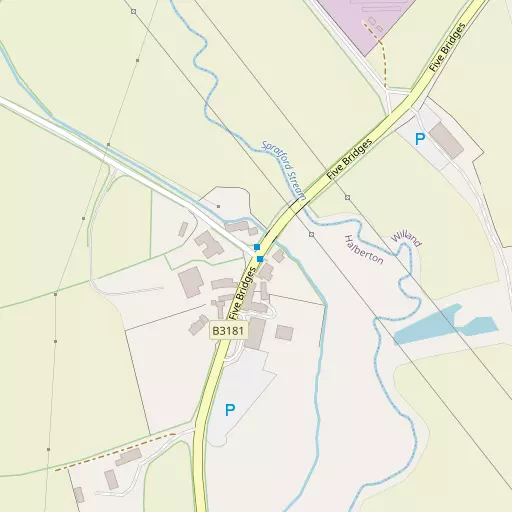
⇅
Location Summary
- Five Bridges is located in Devon
- Administrative Area: Devon
- Ceremonial County: Devon
- Historic County: Devon
- Region & Country: South West / England
⇅
Nearby Towns & Cities
- Cullompton 2.5 km S
- Tiverton 7.7 km WNW
- Wellington 15.9 km NE
- Ottery St Mary 15.9 km SSE
- Exeter 20.0 km SSW


⇅
Nearby Localities
- WillandVillage 1.4 km NE
- StoneyfordVillage 1.7 km S
- Ash ThomasVillage 2.7 km NW
- HalbertonVillage 3.9 km NW
- KentisbeareVillage 4.2 km ESE
- Sampford PeverellVillage 4.8 km N
- UffculmeVillage 5.2 km NE
- ButterleighVillage 5.3 km WSW
- UplowmanVillage 5.7 km N
- YondercottVillage 5.8 km ENE


⇅
Smaller Settlements
- Brithem Bottom 1.8 km WNW
- Ponsford 3.2 km SW
- Knowle 3.2 km SW
- Colebrook 3.9 km SSW
- Aller 4.0 km SE
- Smithincott 4.3 km ENE
- East Butterleigh 4.3 km W
- Mutterton 4.5 km S
- Westcott 5.1 km S
- Higher Weaver 5.4 km SSE


⇅
Beaches
- Jacob's Ladder24.4 km SSE
- Powderham Sand25.2 km S
- Sidmouth Town Beach24.4 km SSE
⇅
Parks
- Pennsylvania Park18.1 km SSW
- Pleasure Grounds45.7 km WSW
- The Lawn33.4 km S
- The Warren60.9 km NW
⇅
Woods
- Leonard Copse2.5 km W
- Moses' Copse1.4 km WNW
- North Copse2.3 km WSW
- Sock Copse2.6 km WNW
⇅
Hills
- Cloggs Hill2.4 km WNW
- Padbrook Hill3.6 km SSW
- Sock Hill3.0 km WNW
- St Andrew's Hill2.1 km SSW
⇅
Lakes
- Chub's Pond3.9 km WSW
- Mill Pond3.4 km NE
- Mill Race3.6 km NE
- Mill Stream4.7 km NE
⇅
Waterfalls
- Becka Falls39.5 km SW
- Broad Falls56.4 km SW
- Horseshoe Falls50.1 km SW
⇅
Headlands
- Brandy Head27.1 km SSE
- Otterton Point28.0 km SSE
⇅
Islands
- Fenning Island45.4 km NE
- Ore Stone47.0 km S
⇅
Wetlands
- Duck's Marsh21.0 km SSW
- Barton Marsh23.5 km NW
- West Mud23.6 km SSW
⇅
Health Services
- Castle Place PracticeHospital 8.3 km WNW
- Ottery St Mary HospitalHospital 15.6 km SSE
- Orchard LeaMedical 2.8 km SSW
- Hay HouseMedical 11.3 km SSW
⇅
Education
- Willand SchoolSchool 1.7 km NE
- St Andrews Primary SchoolSchool 2.2 km SSW
- Exeter AcademyUniversity 18.0 km SSW
⇅
Railway Stations
- Tiverton Parkway4.8 km NNE
- Feniton12.3 km SE

⇅
Bus Stations
- Exeter Bus Station19.4 km SSW
- Taunton Bus Station25.0 km NE
⇅
Coach Stations
- Torquay Coach Station46.0 km SSW
- Plymouth Coach Station77.4 km SW
⇅
Ferry Terminals
- Starcross Pier28.1 km S
- Greenway Quay56.9 km SSW
⇅
Airports
- Exeter Airport15.9 km S
- Cardiff Airport58.1 km N
⇅
Airfields
- Dunkeswell Airfield10.8 km E
- Watchford Farm20.5 km E

⇅
Heliports
- Lake Heliport63.0 km WNW
- Cardiff City Heliport67.9 km NNE
⇅
Harbours
- Lympstone Boat Shelter25.6 km S
- Watchet Harbour34.3 km N