
Gibraltar
About Gibraltar
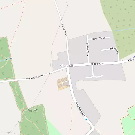
Gibraltar sits within Bedford. Places nearby include Green End lying 500 m North, Keeley Green only 743 m South, Pilgrims Rest lying 981 m East North East, Mount Pleasant situated 1.0 km South and Bott End only 1.3 km South. Other rural localities include Kempston Church End, Kempston West End, Wootton Green and Wick End.
You may find extra local information by clicking a nearby place.
This page uses OS, ONS and OSM data supplied under open licence.
⇅
Local Map
⇅
Location Summary
⇅
Nearby Towns & Cities
⇅
Nearby Localities
⇅
Smaller Settlements
⇅
Other places with this name
- Gibraltar, Buckinghamshire
- Gibraltar, Suffolk
- Gibraltar, Lincolnshire
- Gibraltar, Kent
⇅
Beaches
- Bell Wharf Beach
- Hadleigh Ray
- Mill Beach
⇅
Parks
- Buckwell Green
- Elfield Park
- Foot Meadow
- The Green
⇅
Woods
- Ridgeway Wood
- The Kill
- The Spinney
- Wiles Wood
⇅
Hills
- Castle Hill
- Mushroom Hill
- Oakley Hill
- Strawberry Hill
⇅
Lakes
- Causeway Lake
- Hollow Lake
- Stewartby Lake
- Village Lake
⇅
Waterfalls
- Neptune Waterfall
- The Cascade
- Tower Waterfall
⇅
Headlands
- Botany Bay Point
- Tripcock Ness
⇅
Islands
- Apple Island
- Rink Islands
⇅
Wetlands
- Summer Leys
- Fowlmere
- Waterford Marsh
⇅
Health Services
- Manor Hospital
- Bedford Hospital South Wing
- Bentley Grange
- Elstow Manor
⇅
Education
- Kempston Rural Primary School
- Ridgeway School
- Polhill Campus
⇅
Train Stations
- Kempston Hardwick
- Bedford
⇅
Bus Stations
- Bletchley Bus Station
- North Gate Bus Station
⇅
Coach Stations
- Milton Keynes Coachway
- Luton Airport Bus and Coach Station
⇅
Ferry Terminals
- Embankment Pier
- Festival Pier
⇅
Airports
- London Luton Airport
- Cambridge City Airport
⇅
Airfields
- Cranfield Airport
⇅
Heliports
- Magpas Air Ambulance
⇅
Harbours
- Chelsea Harbour
- Farndon Harbour