
Hall End
About Hall End
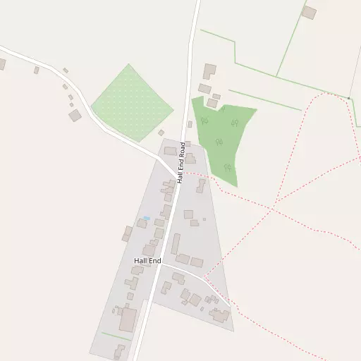
Hall End, in Bedford, has Wood End situated 695 m North North West, Church End lying 827 m South South East, Bott End only 920 m East South East, Mount Pleasant situated 924 m East and Keeley Green situated 927 m East North East. Other rural communities nearby include Kempston West End, Wootton Green, Kempston Church End and Wick End.
You might learn something new by clicking through to a nearby place.
The place data here is drawn from OS, ONS and OSM under open licence.
⇅
Local Map
⇅
Location Summary
⇅
Nearby Towns & Cities
⇅
Nearby Localities
⇅
Smaller Settlements
⇅
Other places with this name
- Hall End, Central Bedfordshire
- Hall End
⇅
Beaches
- Bell Wharf Beach
- Hadleigh Ray
- Mill Beach
⇅
Parks
- Buckwell Green
- Elfield Park
- Foot Meadow
- The Green
⇅
Woods
- Kempston Wood
- Ransom's Wood
- The Kill
- Wootton Wood
⇅
Hills
- Castle Hill
- Heydon Hill
- Mushroom Hill
- Strawberry Hill
⇅
Lakes
- Causeway Lake
- Hollow Lake
- Stewartby Lake
- The Pillinge
⇅
Waterfalls
- Neptune Waterfall
- The Cascade
- Tower Waterfall
⇅
Headlands
- Botany Bay Point
- Tripcock Ness
⇅
Islands
- Apple Island
- Bird Island
⇅
Wetlands
- Summer Leys
- Fowlmere
- Waterford Marsh
⇅
Health Services
- Manor Hospital
- Bedford Hospital South Wing
- The Old Village School Nursing Home
- Elstow Manor
⇅
Education
- Wootton Lower School
- Wootton Upper School and Arts College
- Cranfield University
⇅
Train Stations
- Kempston Hardwick
- Stewartby
⇅
Bus Stations
- Bletchley Bus Station
- North Gate Bus Station
⇅
Coach Stations
- Milton Keynes Coachway
- Luton Airport Bus and Coach Station
⇅
Ferry Terminals
- Embankment Pier
- Festival Pier
⇅
Airports
- London Luton Airport
- Cambridge City Airport
⇅
Airfields
- Cranfield Airport
⇅
Heliports
- Magpas Air Ambulance
⇅
Harbours
- Chelsea Harbour
- Farndon Harbour