
Hazlemere
About Hazlemere
Hazlemere is in Buckinghamshire. Places nearby include Tylers Green just 1.3 km South East, Widmer End around 1.4 km North North West, Terriers just 1.5 km West South West, Holmer Green around 2.0 km North East and Cryers Hill only 2.1 km North West. Other countryside places nearby include Beamond End, Mop End, Woodrow and Lower North Dean.
You may find extra local information by clicking a nearby place.
The details shown here use OS, ONS and OSM data provided under open licence.
⇅
Local Map
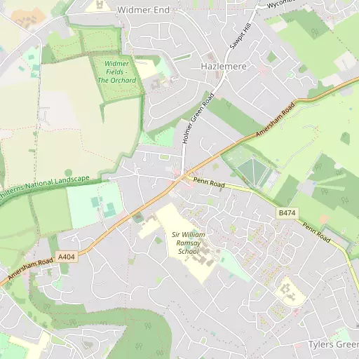
⇅
Location Summary
- Hazlemere is located in Buckinghamshire
- Administrative Area: Buckinghamshire
- Ceremonial County: Buckinghamshire
- Historic County: Buckinghamshire
- Region & Country: South East / England
⇅
Nearby Towns & Cities
- High Wycombe 3.6 km SW
- Beaconsfield 6.5 km SE
- Amersham 7.8 km ENE
- Chesham 9.0 km NE
- St Albans 28.1 km ENE


⇅
Nearby Localities
- Tylers GreenVillage 1.3 km SE
- Widmer EndVillage 1.4 km NNW
- TerriersDistrict 1.5 km WSW
- Holmer GreenVillage 2.0 km NE
- Cryers HillVillage 2.1 km NW
- PennVillage 2.1 km SE
- MicklefieldDistrict 2.7 km S
- Great KingshillVillage 2.8 km NNW
- Heath EndDistrict 2.9 km NNW
- Hughenden ValleyVillage 3.3 km WNW


⇅
Smaller Settlements
- Beamond End 2.7 km ENE
- Mop End 3.6 km ENE
- Woodrow 4.3 km E
- Lower North Dean 4.7 km NW
- Stony Green 5.0 km NNW
- Prestwood 5.6 km NNW
- Sheepridge 6.1 km S
- Hyde End 6.3 km NNE
- Fern 7.0 km S
- Burroughs Grove 7.4 km SSW


⇅
Beaches
- Bishop Saltings94.8 km ESE
- Cotswold Hills Beach86.1 km W
- Hadleigh Ray91.1 km E


⇅
Parks
- Balderson's Moor19.4 km ENE
- Chaulden Meadow18.1 km NE
- Hog Common21.7 km SSE
- The Common25.5 km SW

⇅
Woods
- Cockshoot Wood1.2 km W
- Craig's Wood701 m E
- King's Wood1.3 km S
- Two Sisters Plantation1.4 km ENE
⇅
Hills
- Beacon Hill3.0 km SE
- Hunt's Hill4.5 km WNW
- Keep Hill3.9 km SSW
- Pike Hill5.3 km NNE
⇅
Lakes
- Bank's Pond4.7 km NNE
- Cockpit Hole2.8 km NNW
- Pistle's Pond2.7 km SE
- Wash Pond2.8 km SE
⇅
Waterfalls
- Neptune Waterfall11.2 km ENE
- The Cascade46.6 km NNW
- Tower Waterfall10.7 km ENE
⇅
Headlands
- Botany Bay Point27.9 km SSE
- Tripcock Ness57.8 km ESE
⇅
Islands
- Sherriff Island10.1 km SSW
- Taylor Island10.1 km SSW
⇅
Wetlands
- Cock Marsh8.7 km S
- Wargrave Marsh18.9 km SW
- Ickenham Marsh22.1 km ESE
⇅
Health Services
- The Shelburne HospitalHospital 4.0 km SW
- The Chiltern HospitalHospital 4.5 km NNE
- The Royal Star and Garter HomesMedical 3.1 km WSW
- The HeightsMedical 4.7 km W
⇅
Education
- Hazlemere Church of England Combined SchoolSchool 353 m SSW
- Sir William Ramsay SchoolSchool 431 m S
- GatewayUniversity 3.8 km SW
⇅
Railway Stations
- High Wycombe3.3 km SW
- Great Missenden5.8 km N

⇅
Bus Stations
- High Wycombe Bus Station3.7 km SW
- Slough Bus Station17.6 km SSE
⇅
Coach Stations
- High Wycombe Coachway5.4 km SW
- Luton Airport Bus and Coach Station34.4 km NE
⇅
Ferry Terminals
- Hammerton's Pier35.8 km SE
- Hampton Ferry Boathouse36.0 km SE
⇅
Airports
- Wycombe Air Park8.0 km SW
- London Elstree Aerodrome26.7 km E
⇅
Airfields
- Bovingdon Airfield14.3 km NE
- Denham Aerodrome15.4 km ESE
⇅
Heliports
- The London Heliport42.1 km ESE
- The Egerton-Smith Centre86.6 km NE
⇅
Harbours
- Chelsea Harbour41.7 km ESE
- Hendy's Quay91.1 km S