
Histon, Histon and Impington
About Histon
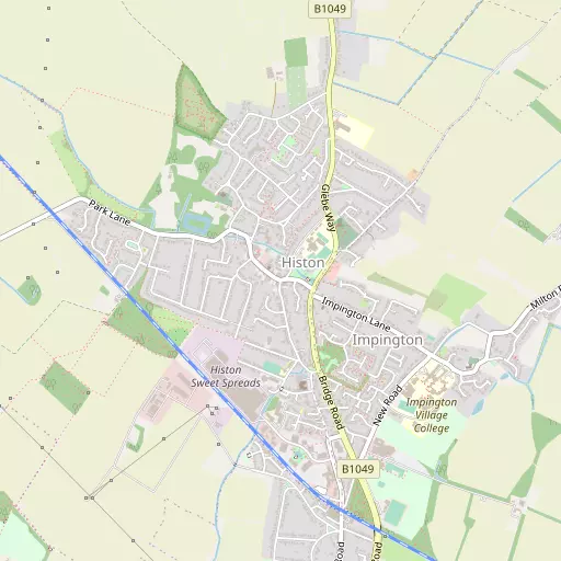
Histon is 472 m SSE from Histon and Impington in the county of Cambridgeshire. Nearby places include Impington situated 472 m South South East, Girton only 2.1 km South West, Orchard Park just 2.3 km South South East, Oakington just 3.0 km West North West and Arbury just 3.1 km South South East. Other communities nearby include Westwick, Northstowe, Clayhithe and Quy Waters.
You might discover something new by clicking a nearby place for more local details.
The details shown here use OS, ONS and OSM data provided under open licence.
⇅
Local Map
⇅
Location Summary
- Histon is a neighbourhood in Histon and Impington
- Administrative Area: Cambridgeshire
- Ceremonial County: Cambridgeshire
- Historic County: Cambridgeshire
- Region & Country: Eastern / England
⇅
Nearby Towns & Cities
- Parent town: Histon and Impington
- St Ives 14.7 km WNW
- Soham 18.1 km ENE
- Newmarket 20.4 km E
- Godmanchester 20.6 km WNW
- Cambridge 5.3 km S


⇅
Nearby Localities
- ImpingtonVillage 472 m SSE
- GirtonVillage 2.1 km SW
- Orchard ParkDistrict 2.3 km SSE
- OakingtonVillage 3.0 km WNW
- ArburyDistrict 3.1 km SSE
- King's HedgesDistrict 3.1 km SSE
- Ridgeway VillageDistrict 3.5 km SSW
- MiltonVillage 3.9 km ESE
- CottenhamVillage 3.9 km NNE
- EddingtonDistrict 4.0 km SSW


⇅
Smaller Settlements
- Westwick 2.5 km NW
- Northstowe 5.3 km NW
- Clayhithe 6.3 km E
- Quy Waters 7.5 km SE
- Childerley 8.5 km WSW
- Chittering 8.7 km NE
- River Bank 10.7 km ENE
- Frog End 10.8 km ESE
- Freestones Corner 11.8 km S
- Upware 11.9 km ENE


⇅
Beaches
- Mill Beach71.6 km SE
- Snettisham Beach71.7 km NNE
- Snettisham Scalp72.9 km NNE
⇅
Parks
- Butt Green5.0 km SSE
- Empty Common6.9 km S
- New Pasture23.2 km WNW
- Wimpole Park15.9 km SW
⇅
Woods
- Arbury Orchard2.1 km S
- Girton Wood1.1 km WSW
- Histon Wood678 m WSW
- Pheasant Plantation4.1 km SSW
⇅
Hills
- Castle Hill4.5 km S
- Craft's Hill5.3 km W
- Missleton Hill9.8 km SSE
- White Hill10.1 km SSE

⇅
Lakes
- Brook Leys4.0 km SSW
- Pellews Pond3.8 km SSW
- Swan Pond1.2 km W
- Todd's Pit4.1 km ESE
⇅
Waterfalls
- Neptune Waterfall78.3 km SW
- The Cascade80.5 km WSW
- Tower Waterfall78.4 km SW
⇅
Headlands
- Tripcock Ness82.6 km S
- West Point91.5 km SSE
⇅
Islands
- Holt Island15.0 km WNW
- Riddy Island11.1 km S
⇅
Wetlands
- Chesterton Fen4.8 km ESE
- Ouse Fen11.3 km NNW
- Gault Hole17.0 km N


⇅
Health Services
- Cambridge Lea HospitalHospital 951 m SSE
- Brookfields HospitalHospital 6.8 km SSE
- Midfield Lodge Nursing HomeMedical 2.1 km W
- Buchan HouseMedical 2.5 km SSE
⇅
Education
- Histon and Impington Brook Primary SchoolSchool 219 m NE
- Histon and Impington County Infants SchoolSchool 468 m S
- Girton CollegeUniversity 2.9 km SSW
⇅
Railway Stations
- Cambridge North4.6 km SE
- Waterbeach6.3 km E
⇅
Bus Stations
- Drummer Street Bus Station5.3 km SSE
- Addenbrooke's Bus Station8.8 km SSE
⇅
Coach Stations
- Stansted Airport Coach Station41.8 km SSE
- Luton Airport Bus and Coach Station52.9 km SW
⇅
Ferry Terminals
- Canary Wharf Pier83.5 km S
- North Greenwich Pier83.6 km S
⇅
Airports
- Cambridge City Airport7.1 km SE
- Stansted Airport41.6 km SSE
⇅
Airfields
- Bourn Airfield11.0 km WSW
- Duxford Airfield17.9 km S
⇅
Heliports
- The Egerton-Smith Centre6.7 km SE
- Magpas Air Ambulance27.9 km WNW
⇅
Harbours
- Harwich Harbour87.6 km ESE
- Chelsea Harbour88.6 km SSW