
River Bank
About River Bank
River Bank lies within Cambridgeshire. Neighbouring places include Reach situated 4.2 km South East, Wicken only 4.3 km East North East, Denny End just 4.9 km South West, Waterbeach situated 5.0 km South West and Newnham around 5.6 km East South East. Other places in the surrounding countryside include Upware, Chittering, Clayhithe and Barway.
You may find extra local information by clicking a nearby place.
Information is sourced from OS, ONS and OSM under open licence, using publicly available datasets.
⇅
Local Map
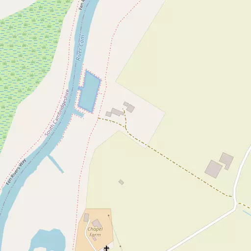
⇅
Location Summary
- River Bank is located in Cambridgeshire
- Administrative Area: Cambridgeshire
- Ceremonial County: Cambridgeshire
- Historic County: Cambridgeshire
- Region & Country: Eastern / England
⇅
Nearby Towns & Cities


⇅
Nearby Localities
- ReachVillage 4.2 km SE
- WickenVillage 4.3 km ENE
- Denny EndDistrict 4.9 km SW
- WaterbeachVillage 5.0 km SW
- NewnhamDistrict 5.6 km ESE
- StrethamVillage 6.0 km NNW
- Swaffham PriorVillage 6.0 km SE
- BurwellVillage 6.1 km ESE
- LodeVillage 6.3 km S
- Commercial EndVillage 6.3 km SSE


⇅
Smaller Settlements
- Upware 1.4 km NNE
- Chittering 3.5 km WNW
- Clayhithe 5.5 km SW
- Barway 7.0 km NNE
- Barcham Corner 8.7 km NE
- Landwade 9.2 km E
- Broad Hill 9.8 km NE
- Quy Waters 10.0 km SSW
- Frog End 10.2 km S
- Westwick 11.8 km WSW


⇅
Beaches
- Snettisham Beach64.3 km NNE
- Snettisham Scalp65.6 km NNE
- Stubborn Sand68.6 km NNE
⇅
Parks
- Butt Green12.6 km SW
- Empty Common14.3 km SW
- Risbridge Meadow27.8 km SE
- Wimpole Park26.2 km SW
⇅
Woods
- Cow Hollow Wood5.3 km SW
- Crow Hill Plantation5.3 km SSE
- St Edmund's Fen3.7 km ENE
- Wicken Poors' Fen3.3 km ENE
⇅
Hills
- Bunkers Hill6.4 km ESE
- Church Hill4.7 km SE
- Hainey Hill7.1 km NNE
- Pound Hill6.2 km ESE
⇅
Lakes
- Brook Dam7.5 km ENE
- Dickerson's Pit8.5 km SW
- Todd's Pit8.6 km SW
- Turks Head Lake7.5 km W
⇅
Waterfalls
- Neptune Waterfall88.1 km SW
- The Cascade91.1 km WSW
- Tower Waterfall88.2 km SW
⇅
Headlands
- North Weir Point87.8 km ESE
- Tripcock Ness88.3 km S
⇅
Islands
- Riddy Island19.1 km SSW
- The Island22.0 km SE
⇅
Wetlands
- Chesterton Fen9.2 km SW
- The Marsh9.9 km ESE
- Gault Hole15.1 km NW

⇅
Health Services
- Cambridge Lea HospitalHospital 10.7 km WSW
- Newmarket HospitalHospital 11.7 km ESE
- Hatley CourtMedical 4.7 km SW
- Waterbeach LodgeMedical 5.5 km SW
⇅
Education
- Waterbeach Community Primary SchoolSchool 4.7 km SW
- Swaffham Prior Church of England Primary SchoolSchool 6.0 km SE
- College of West AngliaUniversity 7.5 km SW
⇅
Railway Stations
- Waterbeach5.1 km SW
- Soham7.0 km NE
⇅
Bus Stations
- Drummer Street Bus Station13.1 km SW
- Addenbrooke's Bus Station15.1 km SSW
⇅
Coach Stations
- Stansted Airport Coach Station45.4 km S
- Luton Airport Bus and Coach Station62.9 km SW
⇅
Ferry Terminals
- Harwich Ferry Port79.0 km ESE
- Burnham Ferry84.5 km SSE
⇅
Airports
- Cambridge City Airport11.4 km SSW
- Stansted Airport45.6 km S
⇅
Airfields
- RAF Mildenhall18.0 km ENE
- Bourn Airfield21.7 km WSW
⇅
Heliports
- The Egerton-Smith Centre11.2 km SSW
- Magpas Air Ambulance34.8 km WNW
⇅
Harbours
- Brancaster Harbour80.9 km NNE
- Harwich Harbour81.2 km ESE