
Langham
About Langham
Langham sits within Somerset. Nearby places include Wadeford around 748 m West North West, Crimchard lying 996 m South, Furnham lying 1.4 km South East and Combe St Nicholas lying 2.0 km West North West. Other rural settlements include Cuttiford's Door, Chardleigh Green, Pudleigh, Nimmer and New England.
You may find extra local information by clicking a nearby place.
Data shown here comes from OS, ONS and OSM under open licence, using the latest public sources available.
⇅
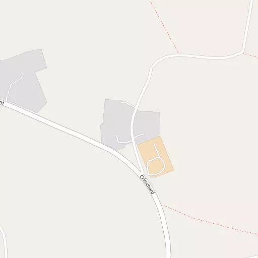
Local Map
⇅
Location Summary
- Langham is located in Somerset
- Administrative Area: Somerset
- Ceremonial County: Somerset
- Historic County: Somerset
- Region & Country: South West / England
⇅
Nearby Towns & Cities


⇅
Nearby Localities
- WadefordVillage 748 m WNW
- CrimchardDistrict 996 m S
- FurnhamDistrict 1.4 km SE
- Combe St NicholasVillage 2.0 km WNW
- Jocelyn ParkDistrict 2.2 km SSE
- HolbearDistrict 2.7 km SSE
- ChaffcombeVillage 3.3 km E
- WambrookVillage 3.5 km SW
- FortonVillage 3.6 km SSE
- DonyattVillage 4.4 km NNE


⇅
Smaller Settlements
- Cuttiford's Door 421 m ESE
- Chardleigh Green 492 m WNW
- Pudleigh 629 m NNW
- Nimmer 908 m NNE
- New England 1.1 km ENE
- Clayhanger 1.2 km N
- Cat Tail 1.3 km WNW
- Hornsbury 1.6 km ENE
- Knowle St Giles 2.9 km ENE
- Peasmarsh 3.0 km NE


⇅
Other places with this name
- Langham, Dorset 47.9 km ENE
- Langham, Rutland 252.0 km NE
- Langham, Essex 296.3 km ENE
- Langham, Suffolk 309.5 km ENE
- Langham, Norfolk 353.7 km NE
⇅
Beaches
- Charmouth Beach17.7 km SSE
- Cobb Gate Beach18.3 km S
- Front Beach18.5 km S
⇅
Parks
- Pennsylvania Park42.2 km WSW
- The Lawn48.9 km SW
- Worle Moor52.3 km N
- Yargrass Green42.0 km NNE

⇅
Woods
- Combe Wood2.1 km WNW
- Hale's Copse1.3 km WSW
- Helliar's Copse2.1 km NNE
- Week's Coppice1.8 km W

⇅
Hills
- Barley Hill2.9 km NNW
- Foxdon Hill1.1 km W
- Snowdon Hill1.5 km SW
- Sticklepath Hill3.1 km NNW
⇅
Lakes
- Chard Reservoir2.0 km E
- Laps Water5.2 km W
- Mermaid Pond6.5 km SE
- Spittle Pond2.6 km WSW
⇅
Waterfalls
- Becka Falls63.2 km WSW
- Broad Falls79.2 km SW
- Horseshoe Falls72.5 km SW
⇅
Headlands
- Brandy Head35.4 km SW
- Stert Point37.0 km N
⇅
Islands
- Fenning Island36.8 km N
- Stert Island38.7 km N
⇅
Wetlands
- Farway Marsh5.4 km SSW
- Champernhayes Marsh13.6 km SSE
- Cockpits17.6 km SSE

⇅
Health Services
- Chard and District Community HospitalHospital 1.8 km SE
- Axminster HospitalHospital 11.6 km S
- Oak LodgeMedical 2.3 km SSE
- Horton Cross Nuring HomeMedical 5.6 km NNE
⇅
Education
- Dimensions School for Special NeedsSchool 390 m WNW
- The Redstart Primary SchoolSchool 822 m SSE
- Architectural Association Hooke ParkUniversity 23.4 km ESE
⇅
Railway Stations
- Axminster12.3 km SSW
- Crewkerne13.5 km E
⇅
Bus Stations
- Taunton Bus Station17.1 km NNW
- Exeter Bus Station42.8 km WSW
⇅
Coach Stations
- Torquay Coach Station60.8 km SW
- Millstream Coach Park84.6 km ENE
⇅
Ferry Terminals
- Starcross Pier44.2 km SW
- SS Great Britain Ferry Landing67.4 km NNE
⇅
Airports
- Exeter Airport35.4 km WSW
- Bristol Airport57.9 km NNE
⇅
Airfields
- Royal Navy Air Station Merryfield9.0 km NNE
- Watchford Farm9.1 km WNW
⇅
Heliports
- Cardiff City Heliport65.6 km N
- Lake Heliport91.2 km W
⇅
Harbours
- Bridport Harbour24.4 km SE
- Watchet Harbour41.4 km NW
