
Luton
About Luton
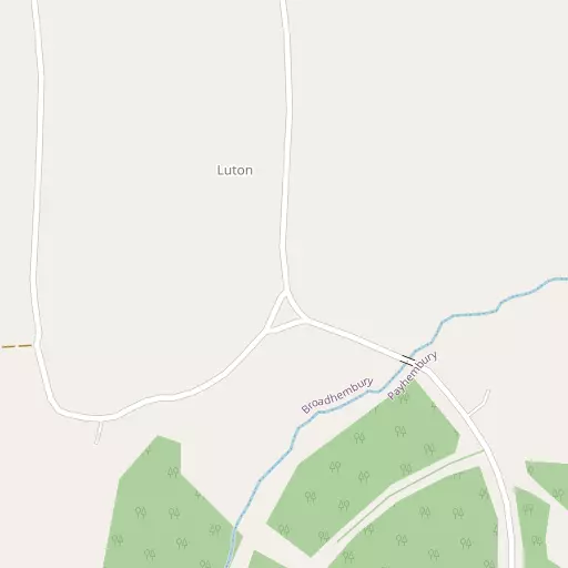
Luton lies within Devon. Local places nearby include Payhembury situated 1.2 km South South East, Broadhembury lying 2.7 km North East, Norman's Green situated 2.8 km West North West and Plymtree around 3.1 km West. Other rural places nearby include Clyst William, Upton, Lower Tale, Higher Tale and Colestocks.
You might learn something new by clicking through to a nearby place.
The details shown here use OS, ONS and OSM data provided under open licence.
⇅
Local Map
⇅
Location Summary
- Luton is located in Devon
- Administrative Area: Devon
- Ceremonial County: Devon
- Historic County: Devon
- Region & Country: South West / England
⇅
Nearby Towns & Cities
- Cullompton 7.5 km NW
- Ottery St Mary 7.6 km SSE
- Honiton 8.3 km ESE
- Sidmouth 15.7 km SSE
- Exeter 19.3 km WSW


⇅
Nearby Localities
- PayhemburyVillage 1.2 km SSE
- BroadhemburyVillage 2.7 km NE
- Norman's GreenVillage 2.8 km WNW
- PlymtreeVillage 3.1 km W
- KerswellVillage 3.3 km N
- TalatonVillage 3.5 km SSW
- FenitonVillage 3.7 km SSE
- NewtownDistrict 4.0 km SSW
- BuckerellVillage 4.5 km ESE
- Clyst HydonVillage 4.8 km WSW


⇅
Smaller Settlements
- Clyst William 1.2 km W
- Upton 1.6 km E
- Lower Tale 1.7 km WSW
- Higher Tale 2.1 km SW
- Colestocks 2.4 km SSE
- Fordmoor 2.5 km W
- Lower Cheriton 2.6 km SE
- Higher Cheriton 2.8 km SE
- Dulford 3.2 km NNW
- Higher Weaver 3.8 km WNW


⇅
Other places with this name
- Luton, Devon31.5 km SW
- Luton, Luton 232.6 km ENE
- Luton, Medway 275.6 km ENE

⇅
Beaches
- Branscombe Ebb18.3 km SE
- Jacob's Ladder16.5 km S
- Sidmouth Town Beach16.2 km SSE

⇅
Parks
- Pennsylvania Park17.7 km WSW
- Pleasure Grounds49.6 km W
- The Lawn28.8 km SSW
- Yargrass Green62.6 km NE
⇅
Woods
- Alder Grove334 m SSW
- Danes Mill Copse685 m NW
- Luton Green96 m SSE
- Tything Barn Copse907 m NNE

⇅
Hills
- Buckerell Knap4.7 km ESE
- Castle Hill4.7 km SE
- Cheriton Hill3.2 km SE
- North Hill4.3 km NNE
⇅
Lakes
- Mill Pond9.5 km NNW
- Mill Race9.5 km NNW
- Purky Pool5.9 km SW
- Rough Grey Pond8.2 km NE
⇅
Waterfalls
- Becka Falls39.3 km SW
- Broad Falls55.8 km SW
- Horseshoe Falls49.2 km SW
⇅
Headlands
- Brandy Head19.6 km S
- Otterton Point20.8 km S
⇅
Islands
- Ore Stone41.8 km SSW
- Thatcher Rock42.3 km SSW
⇅
Wetlands
- Weston Ebb17.5 km SSE
- Duck's Marsh19.3 km SW
- West Mud19.9 km SW
⇅
Health Services
- Ottery St Mary HospitalHospital 7.5 km S
- Honiton HospitalHospital 8.6 km ESE
- Orchard LeaMedical 7.6 km WNW
- Kings Manor Care HomeMedical 7.8 km S
⇅
Education
- Payhembury Church of England Primary SchoolSchool 1.2 km SSE
- Broadhembury Church of England Primary SchoolSchool 2.7 km NE
- Exeter AcademyUniversity 17.5 km WSW
⇅
Railway Stations
- Feniton3.7 km SSE
- Whimple6.6 km SSW
⇅
Bus Stations
- Exeter Bus Station18.5 km WSW
- Taunton Bus Station26.0 km NNE
⇅
Coach Stations
- Torquay Coach Station41.6 km SSW
- Plymouth Coach Station77.2 km SW
⇅
Ferry Terminals
- Starcross Pier23.4 km SSW
- Greenway Quay52.5 km SSW
⇅
Airports
- Exeter Airport12.0 km SW
- Cardiff Airport64.7 km N
⇅
Airfields
- Dunkeswell Airfield7.1 km NE
- Farway Common Airfield12.8 km SE
⇅
Heliports
- Lake Heliport70.6 km WNW
- Cardiff City Heliport73.2 km N
⇅
Harbours
- Lympstone Boat Shelter20.9 km SSW
- Bridport Harbour39.8 km ESE