
Middle Marwood
About Middle Marwood
Middle Marwood, in Devon, has Milltown around 1.7 km East, Prixford only 2.4 km South South East, Muddiford only 2.6 km East South East and Ashford around 3.7 km South. Other countryside settlements include Patsford, Whiddon, Marwood, Guineaford and Pippacott.
You may find out something new or interesting if you click a nearby place to see more local information.
This page uses OS, ONS and OSM data supplied under open licence.
⇅
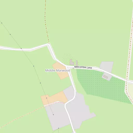
Local Map
⇅
Location Summary
- Middle Marwood is located in Devon
- Administrative Area: Devon
- Ceremonial County: Devon
- Historic County: Devon
- Region & Country: South West / England
⇅
Nearby Towns & Cities
- Barnstaple 6.0 km SSE
- Ilfracombe 8.7 km NNW
- Northam 13.1 km SW
- Bideford 14.9 km SSW
- Abertawe 55.4 km N


⇅
Nearby Localities
- MilltownVillage 1.7 km E
- PrixfordVillage 2.4 km SSE
- MuddifordVillage 2.6 km ESE
- AshfordVillage 3.7 km S
- West DownVillage 3.9 km NW
- KnowleVillage 4.5 km W
- Heanton PunchardonVillage 4.7 km SW
- BradifordDistrict 5.0 km SSE
- PottingtonDistrict 5.2 km SSE
- ChivenorVillage 5.2 km SW


⇅
Smaller Settlements
- Patsford 801 m NW
- Whiddon 1.4 km E
- Marwood 1.5 km SSE
- Guineaford 1.8 km SE
- Pippacott 2.0 km SSW
- Kingsheanton 2.3 km SE
- Halsinger 2.3 km W
- Bittadon 2.4 km NNE
- Boode 3.8 km WSW
- Middle Winsham 3.9 km W


⇅
Beaches
- Hele Beach9.0 km N
- Horsey Ridge8.6 km SW
- Larkstone Beach8.9 km N
⇅
Parks
- Lock's Common47.0 km NNE
- Pleasure Grounds44.5 km S
- Summerleaze Down45.9 km SW
- The Warren9.6 km N
⇅
Woods
- Patsford Wood733 m WNW
- Rock Wood1.2 km S
- Spencer's Wood769 m S
- Tathill Wood680 m SSE

⇅
Hills
- Braunton Down3.6 km WSW
- Mark's Hill2.3 km SW
- Pudnor Hill4.1 km SE
- Snow Ball2.6 km NW
⇅
Lakes
- Saltpill Duck Pond6.7 km SSW
- Slade Reservoirs7.1 km NNW
- Sowden Reservoir6.7 km SSE
- Upper Reservoir7.0 km NNW
⇅
Waterfalls
- Aberdulais Falls65.0 km NNE
- Becka Falls62.9 km SSE
- White Lady Waterfall55.5 km S
⇅
Headlands
- Brandy Cove Point9.2 km NNW
- Breakneck Point9.2 km NNW
⇅
Islands
- Horsey Island7.9 km SW
- Sexton's Burrow9.7 km N
⇅
Wetlands
- Penhill Ridge4.7 km SSW
- Bassett's Ridge5.3 km SSW
- Chivenor Ridge6.0 km SSW
⇅
Health Services
- North Devon District HospitalHospital 5.2 km SSE
- Ilfracombe Tyrrell HospitalHospital 8.5 km NNW
- Heaton Nursing HomeMedical 4.9 km SW
- TyspaneMedical 5.1 km WSW
⇅
Education
- Marwood SchoolSchool 1.2 km E
- West Down County Primary SchoolSchool 4.0 km NW
- PetrocUniversity 6.7 km SSE
⇅
Railway Stations
- Barnstaple6.6 km SSE
- Chapelton13.6 km SSE
⇅
Bus Stations
- Barnstaple Bus Station6.3 km SSE
- Gorsaf Fysiau Pen-y-Bont ar Ogwr55.1 km NE

⇅
Coach Stations
- Torquay Coach Station82.8 km SSE
- Plymouth Coach Station84.3 km S
⇅
Ferry Terminals
- Priory Bay Jetty70.4 km NW
- Starcross Pier72.1 km SE
⇅
Airports
- Swansea Airport52.5 km N
- Cardiff Airport59.8 km ENE

⇅
Airfields
- Chivenor Airfield6.2 km SW
- Belle Vue Airfield17.0 km S
⇅
Heliports
- Lake Heliport15.6 km SW
- Hartland Heliport32.3 km WSW
⇅
Harbours
- Lynmouth Harbour21.4 km ENE
- Watchet Harbour53.5 km E