
Milltown
About Milltown
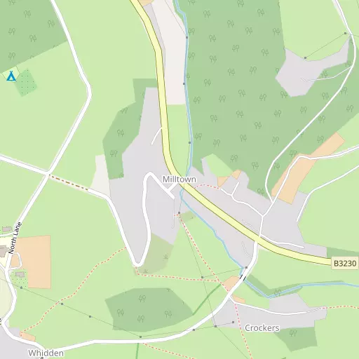
Milltown, in Devon, has Muddiford just 1.0 km South East, Prixford situated 2.2 km South South West, Shirwell Cross lying 3.9 km East South East and Ashford lying 4.3 km South South West. Other rural localities include Whiddon, Guineaford, Marwood, Middle Marwood and Kingsheanton.
You may find extra local information by clicking a nearby place.
This information is based on OS, ONS and OSM data released under open licence.
⇅
Local Map
⇅
Location Summary
- Milltown is located in Devon
- Administrative Area: Devon
- Ceremonial County: Devon
- Historic County: Devon
- Region & Country: South West / England
⇅
Nearby Towns & Cities
- Barnstaple
- Ilfracombe
- Northam
- Bideford
- Abertawe
⇅
Nearby Localities
⇅
Smaller Settlements
⇅
Other places with this name
- Milltown, Cornwall
- Milltown, Cornwall
- Milltown, Derbyshire
- Milltown, Dumfries and Galloway
- Milltown, Highland
⇅
Beaches
- Broad Strand
- Combe Martin Beach
- Newberry Beach
⇅
Parks
- Lock's Common
- Pleasure Grounds
- Summerleaze Down
- The Warren
⇅
Woods
- Furzeclose Plantation
- Spion Kop Plantation
- Tugela Plantation
- Whitefield Wood
⇅
Hills
- Churchill Down
- Mark's Hill
- Pudnor Hill
- Snow Ball
⇅
Lakes
- Saltpill Duck Pond
- Slade Reservoirs
- Sowden Reservoir
- Upper Reservoir
⇅
Waterfalls
- Aberdulais Falls
- Becka Falls
- White Lady Waterfall
⇅
Headlands
- Lester Point
- Widmouth Head
⇅
Islands
- Burrow Nose
- Horsey Island
⇅
Wetlands
- Penhill Ridge
- Bassett's Ridge
- Chivenor Ridge
⇅
Health Services
- North Devon District Hospital
- Ilfracombe Tyrrell Hospital
- Heaton Nursing Home
- Tyspane
⇅
Education
- Marwood School
- Shirwell Community Primary School
- Petroc
⇅
Train Stations
- Barnstaple
- Chapelton
⇅
Bus Stations
- Barnstaple Bus Station
- Gorsaf Fysiau Pen-y-Bont ar Ogwr
⇅
Coach Stations
- Torquay Coach Station
- Plymouth Coach Station
⇅
Ferry Terminals
- Starcross Pier
- Priory Bay Jetty
⇅
Airports
- Swansea Airport
- Cardiff Airport
⇅
Airfields
- Chivenor Airfield
⇅
Heliports
- Lake Heliport
⇅
Harbours
- Lynmouth Harbour
- Watchet Harbour