
Orlingbury
About Orlingbury
Orlingbury is in North Northamptonshire. Local places nearby include Little Harrowden around 1.2 km South East, Pytchley around 2.5 km North, Great Harrowden only 2.5 km South East and Hardwick around 2.6 km South South West. Other rural areas close to here include Hill Top, Orton, Foxhall, Knuston and Farndish.
You might discover something new by clicking a nearby place for more local details.
This page uses OS, ONS and OSM data supplied under open licence.
⇅
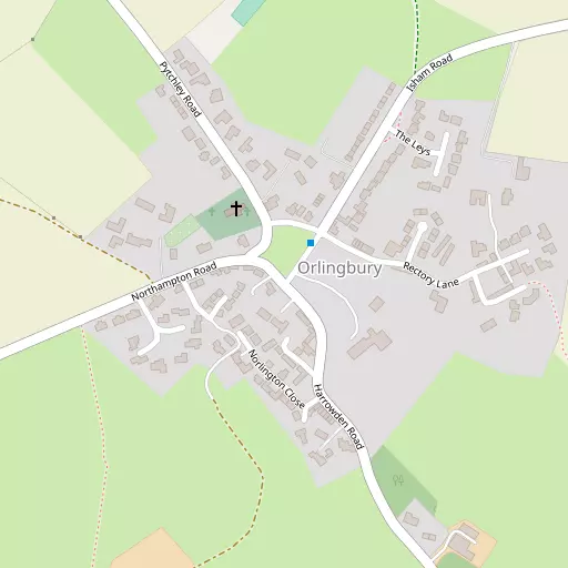
Local Map
⇅
Location Summary
- Orlingbury is located in North Northamptonshire
- Administrative Area: North Northamptonshire
- Ceremonial County: North Northamptonshire
- Historic County: North Northamptonshire
- Region & Country: East Midlands / England
⇅
Nearby Towns & Cities
- Burton Latimer 4.7 km ENE
- Wellingborough 5.4 km SE
- Kettering 6.5 km N
- Irthlingborough 8.8 km E
- Milton Keynes 33.2 km S


⇅
Nearby Localities
- Little HarrowdenVillage 1.2 km SE
- PytchleyVillage 2.5 km N
- Great HarrowdenVillage 2.5 km SE
- HardwickVillage 2.6 km SSW
- IshamVillage 2.8 km ENE
- BroughtonVillage 4.3 km NW
- Hatton ParkDistrict 4.4 km SSE
- Little CransleyDistrict 4.7 km NNW
- Burrow's BushDistrict 4.8 km SE
- HanningtonVillage 4.9 km WSW


⇅
Smaller Settlements

⇅
Beaches
- Snettisham Beach98.8 km NE
- Snettisham Scalp99.2 km NE
- Stubborn Sand101.8 km NE

⇅
Parks
- Buckwell Green4.9 km SSE
- Foot Meadow16.4 km SW
- The Green20.7 km SW
- The Green30.5 km S

⇅
Woods
- Big Covert1.6 km ENE
- Foxhill Spinney2.1 km NNE
- Lammas Spinney582 m ESE
- Roadside Spinney494 m SSE

⇅
Hills
- Beacon Hill10.5 km SSE
- Crow Hill9.3 km E
- Red Hill2.6 km SE
- Woodford Hill10.7 km ENE
⇅
Lakes
- Cransley Reservoir6.6 km NNW
- Holcot Arm7.3 km WSW
- Park Pond6.3 km SW
- Walgrave Arm7.1 km W

⇅
Waterfalls
- Neptune Waterfall74.9 km S
- The Cascade39.8 km SSW
- Tower Waterfall74.4 km S
⇅
Headlands
- Botany Bay Point103.9 km S
- Tripcock Ness108.7 km SSE
⇅
Islands
- Heron Island18.1 km SSE
- Millholme Island18.7 km SSE
⇅
Wetlands
- Summer Leys9.0 km SSE
- Lucas Marsh36.3 km NW
- West Marsh41.9 km NNE
⇅
Health Services
- St Mary's HospitalHospital 5.9 km NNE
- Isebrook HospitalHospital 6.2 km SE
- Claremont Parkway Nursing HomeMedical 4.2 km NNE
- The WillandsMedical 4.4 km NE
⇅
Education
- Little Harrowden Community Primary SchoolSchool 1.2 km ESE
- Pytchley Endowed Church of England Primary SchoolSchool 2.4 km N
- Wellingborough CampusUniversity 5.2 km SE
⇅
Railway Stations
- Kettering5.8 km N
- Wellingborough6.1 km SE
⇅
Bus Stations
- North Gate Bus Station15.8 km SW
- Daventry Bus Station30.2 km WSW
⇅
Coach Stations
- Milton Keynes Coachway31.9 km S
- Luton Airport Bus and Coach Station57.1 km SSE
⇅
Ferry Terminals
- Normanton Chain Ferry60.9 km NNW
- Embankment Pier102.0 km SSE
⇅
Airports
- Coventry Airport50.6 km W
- London Luton Airport57.6 km SSE
⇅
Airfields
- Sywell Aerodrome5.4 km SW
- Sackfield Airfield19.4 km ESE
⇅
Heliports
- Magpas Air Ambulance33.5 km E
- Nottingham Heliport58.7 km NNW
⇅
Harbours
- Farndon Harbour80.6 km N
- Chelsea Harbour103.7 km SSE