
Poughill
About Poughill
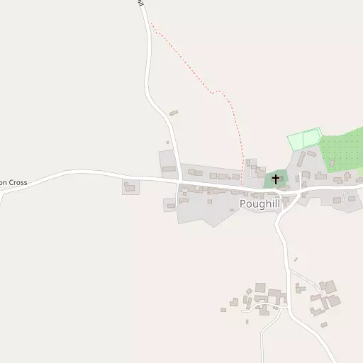
Poughill sits within Devon. Nearby places include Cheriton Fitzpaine situated 2.8 km South East, Pennymoor lying 2.9 km North North East, Puddington only 3.1 km North West and Black Dog just 5.1 km West North West. Other countryside places nearby include Stockleigh English, Woolfardisworthy, Upham, East Village and Kennerleigh.
You may find out something new or interesting if you click a nearby place to see more local information.
This information is based on OS, ONS and OSM data released under open licence.
⇅
Local Map
⇅
Location Summary
- Poughill is located in Devon
- Administrative Area: Devon
- Ceremonial County: Devon
- Historic County: Devon
- Region & Country: South West / England
⇅
Nearby Towns & Cities
⇅
Nearby Localities
⇅
Smaller Settlements
⇅
Other places with this name
⇅
Beaches
- Cockle Sand
- Powderham Sand
- Starcross Sand
⇅
Parks
- Pennsylvania Park
- Pleasure Grounds
- The Lawn
- The Warren
⇅
Woods
- Little Brake Copse
- Little Gore Plantation
- Taylor's Copse
- Thurlow's Copse
⇅
Hills
- Emlett Hill
- Little Hill
- Windmill Down
- Windmill Hill
⇅
Lakes
- Allers Ponds
- Bradford Pond
- Combe Fish Ponds
- Shoebrooke Lake
⇅
Waterfalls
- Becka Falls
- Horseshoe Falls
- White Lady Waterfall
⇅
Headlands
- Brandy Head
- Otterton Point
⇅
Islands
- Bellpool Island
- Island of Rocks
⇅
Wetlands
- Long Marsh
- Roach Marsh
- Barton Marsh
⇅
Health Services
- Crediton Hospital
- Castle Place Practice
- Langford Park
- Barton Place
⇅
Education
- Cheriton Fitzpaine Primary School
- Sandford School
- Duryard Halls of Residence
⇅
Train Stations
- Crediton
- Newton St Cyres
⇅
Bus Stations
- Exeter Bus Station
- Barnstaple Bus Station
⇅
Coach Stations
- Torquay Coach Station
- Plymouth Coach Station
⇅
Ferry Terminals
- Starcross Pier
- Greenway Quay
⇅
Airports
- Exeter Airport
- Plymouth City Airport
⇅
Airfields
- Eggesford Airfield
⇅
Heliports
- Lake Heliport
⇅
Harbours
- Lympstone Boat Shelter
- Watchet Harbour