
Swinethorpe
About Swinethorpe
Swinethorpe is in Lincolnshire. Among the nearby places are Harby around 1.5 km North North East, Wigsley only 1.5 km West North West, Eagle Moor situated 1.8 km South East, Eagle just 2.4 km South and Doddington situated 2.7 km East. Other rural communities nearby include Thorney Moor, Spalford, Eagle Hall and Eagle Barnsdale.
You may find out something new or interesting if you click a nearby place to see more local information.
This information is based on OS, ONS and OSM data released under open licence.
⇅
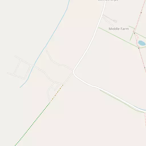
Local Map
⇅
Location Summary
- Swinethorpe is located in Lincolnshire
- Administrative Area: Lincolnshire
- Ceremonial County: Lincolnshire
- Historic County: Lincolnshire
- Region & Country: East Midlands / England
⇅
Nearby Towns & Cities
- North Hykeham 7.0 km ESE
- Newark-on-Trent 17.3 km SSW
- Retford 20.5 km NW
- Gainsborough 21.3 km NNW
- Lincoln 10.4 km ENE


⇅
Nearby Localities
- Harby Village 1.5 km NNE
- Wigsley Village 1.5 km WNW
- Eagle MoorVillage 1.8 km SE
- EagleVillage 2.4 km S
- DoddingtonVillage 2.7 km E
- WhisbyVillage 3.2 km ESE
- North ScarleVillage 3.5 km SW
- Thorney Village 4.2 km NNW
- Thorpe on the HillVillage 4.5 km SE
- JerusalemDistrict 4.5 km ENE


⇅
Smaller Settlements
- Thorney Moor 2.8 km NNW
- Spalford 3.7 km W
- Eagle Hall 4.0 km SSW
- Eagle Barnsdale 4.0 km S
- Drinsey Nook 4.8 km N
- Broadholme 5.1 km NNE
- Morton Hall 5.2 km S
- Morton 5.7 km S
- Girton 6.0 km WSW
- Redmay Corner 6.1 km SSW


⇅
Beaches
- Ellerker Foreshore57.4 km N
- Humberston Fitties Beach58.9 km NE
- Whitgift Sand54.0 km N

⇅
Parks
- Bulwell Forest40.3 km SW
- Burgage Green22.8 km SW
- Doncaster Common43.1 km NW
- Wilsford Warren30.2 km SSE

⇅
Woods
- Crow Wood1.1 km ESE
- Fox Holt924 m E
- Hurn Wood1.2 km SE
- Parson's Wood1.2 km ESE
⇅
Hills
- Clifton Hill5.2 km W
- Magtree Hill4.9 km NE
- Slack's Hill3.0 km S
- Strunch Hill1.7 km ENE
⇅
Lakes
- Bubble Dyke6.5 km WNW
- Hall Water Reservoir6.0 km NW
- Hartsholme Lake6.9 km E
- Swanholme Lakes7.0 km E
⇅
Waterfalls
- Goitstock Waterfall104.1 km NW
- Kinder Downfall81.3 km WNW
- Lumb Fall98.9 km WNW
⇅
Headlands
- Flamborough Head107.9 km NNE
- Red Cliff Point116.4 km NNE
⇅
Islands
- Branston Island22.5 km E
- Torksey Island10.4 km NNW
⇅
Wetlands
- Smithy Marsh7.0 km WSW
- Laughterton Marsh8.4 km NW
- Lea Marsh18.1 km NNW
⇅
Health Services
- Lincoln Private HospitalHospital 10.9 km ENE
- Lincoln County HospitalHospital 11.7 km E
- The Grove Nursing HomeMedical 5.5 km ENE
- St Claire's Nursing HomeMedical 6.0 km E
⇅
Education
- Harby Queen Eleanor County Primary SchoolSchool 1.7 km NNE
- Eagle Community Primary SchoolSchool 2.2 km S
- University of LincolnUniversity 9.3 km E
⇅
Railway Stations
- Swinderby5.2 km S
- Saxilby6.1 km NNE
⇅
Bus Stations
- Lincoln Central Bus Station10.3 km E
- Newark Bus Station17.5 km SSW
⇅
Coach Stations
- Chesterfield Coach Station49.1 km W
- Meadowhall Interchange52.9 km WNW
⇅
Ferry Terminals
- Normanton Chain Ferry58.6 km SW
- Hull Ferry Port64.7 km NNE
⇅
Airports
- Wickenby Aerodrome25.3 km ENE
- Doncaster Sheffield Airport35.8 km NW
⇅
Airfields
- RAF Waddington12.5 km ESE
- Caunton Airfield17.0 km SW
⇅
Heliports
- Lincs and Notts Air Ambulance HQ13.1 km ESE
- Nottingham Heliport47.6 km SSW
⇅
Harbours
- Farndon Harbour19.9 km SSW
- South Killingholme Haven57.1 km NE