
Toynton Fen Side
About Toynton Fen Side
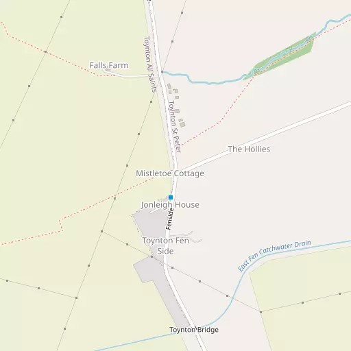
Toynton Fen Side is in Lincolnshire. Places nearby include Toynton St Peter lying 1.0 km North East, Toynton All Saints just 1.6 km North North West, East Keal around 2.3 km North West, Halton Fenside lying 2.8 km East North East and Keal Cotes situated 3.0 km West South West. Other rural communities nearby include Midville, Hagnaby, Monksthorpe and Mavis Enderby.
You may find out something new or interesting if you click a nearby place to see more local information.
These details are compiled from OS, ONS and OSM data released under open licence.
⇅
Local Map
⇅
Location Summary
- Toynton Fen Side is located in Lincolnshire
- Administrative Area: Lincolnshire
- Ceremonial County: Lincolnshire
- Historic County: Lincolnshire
- Region & Country: East Midlands / England
⇅
Nearby Towns & Cities
- Spilsby 3.9 km NNE
- Wainfleet All Saints 10.7 km ESE
- Horncastle 15.5 km WNW
- Skegness 16.7 km E
- Lincoln 42.9 km WNW


⇅
Nearby Localities
- Toynton St PeterVillage 1.0 km NE
- Toynton All SaintsVillage 1.6 km NNW
- East KealVillage 2.3 km NW
- Halton FensideVillage 2.8 km ENE
- Keal CotesVillage 3.0 km WSW
- West KealVillage 3.3 km WNW
- Halton HolegateVillage 3.6 km NE
- Little SteepingVillage 4.0 km E
- HundlebyDistrict 4.2 km N
- StickfordVillage 4.5 km WSW


⇅
Smaller Settlements
- Midville 4.3 km SSW
- Hagnaby 5.1 km W
- Monksthorpe 5.5 km ENE
- Mavis Enderby 5.5 km NW
- Thorpe Fendykes 5.9 km ESE
- Hagnaby Lock 6.1 km WSW
- Kirkby Fenside 6.4 km W
- Hareby 6.9 km WNW
- Lade Bank 7.0 km SSE
- Scremby 7.4 km NE


⇅
Beaches
- Chapel St Leonards Beach19.7 km ENE
- Ingoldmells Beach19.0 km ENE
- Skegness Beach17.6 km E
⇅
Parks
- Bulwell Forest86.1 km W
- Burgage Green69.4 km W
- Larks Green62.7 km SSW
- Wilsford Warren41.1 km WSW
⇅
Woods
- Hare Hills1.3 km E
- Jenkin's Carr2.2 km NNW
- Keal Carr2.6 km NNW
- The Wilderness2.6 km N
⇅
Hills
- Hall Hill3.9 km WNW
- Hubbard Hill2.2 km E
- Mardon Hill2.9 km NW
- Wood Hill4.2 km NNW
⇅
Lakes
- Icehouse Pond8.2 km ENE
- Island Pond7.8 km ENE
- The Canal2.8 km N
- The Moat3.0 km N
⇅
Waterfalls
- Birch Fall148.4 km NNW
- Kinder Downfall133.6 km WNW
- The Cascade144.4 km SSW
⇅
Headlands
- Flamborough Head109.2 km N
- Red Cliff Point125.7 km NNW
⇅
Islands
- Branston Island30.7 km WNW
- Outer Trial Bank34.7 km SSE
⇅
Wetlands
- Friskney Marsh11.6 km SE
- New Marsh12.4 km ESE
- Wrangle Marsh12.8 km SSE

⇅
Health Services
- Skegness and District HospitalHospital 16.4 km E
- Pilgrim HospitalHospital 17.6 km SSW
- The Old HallMedical 3.7 km NE
- South Wold Nursing HomeMedical 13.7 km NNW
⇅
Education
- Toynton All Saints Primary SchoolSchool 1.3 km N
- The Toynton Campus College of Further EducationSchool 2.0 km N
- Boston CollegeUniversity 14.8 km WNW
⇅
Railway Stations
- Thorpe Culvert7.8 km ESE
- Wainfleet10.6 km ESE
⇅
Bus Stations
- Louth Bus Station25.9 km NNW
- Hunstanton Bus Station35.0 km SE
⇅
Coach Stations
- Chesterfield Coach Station101.4 km W
- Meadowhall Interchange104.3 km WNW
⇅
Ferry Terminals
- Hull Ferry Port71.4 km NNW
- Normanton Chain Ferry95.9 km WSW
⇅
Airports
- Wickenby Aerodrome35.1 km NW
- Humberside Airport56.7 km NNW
⇅
Airfields
- Croft11.2 km E
- RAF Coningsby17.9 km WSW
⇅
Heliports
- Lincs and Notts Air Ambulance HQ39.8 km W
- Nottingham Heliport81.9 km WSW
⇅
Harbours
- Brancaster Harbour42.3 km ESE
- South Killingholme Haven58.2 km NNW