
Tremethick Cross
About Tremethick Cross
Tremethick Cross sits within Cornwall. Places nearby include Madron situated 1.7 km North North East, Alverton around 2.0 km East South East, Drift lying 2.0 km South and Heamoor just 2.1 km East North East. Other rural localities include Tregavarah, Trereife, Sellan, Sancreed and Boswarthen.
You may find extra local information by clicking a nearby place.
These details are compiled from OS, ONS and OSM data released under open licence.
⇅
Local Map
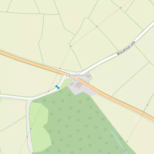
⇅
Location Summary
- Tremethick Cross is located in Cornwall
- Administrative Area: Cornwall
- Ceremonial County: Cornwall
- Historic County: Cornwall
- Region & Country: South West / England
⇅
Nearby Towns & Cities


⇅
Nearby Localities


⇅
Smaller Settlements
- Tregavarah 762 m SSE
- Trereife 1.3 km SE
- Sellan 1.5 km WSW
- Sancreed 2.6 km WSW
- Boswarthen 2.6 km N
- Lower Bodinnar 2.6 km WNW
- Kerris 3.4 km S
- Carfury 3.6 km N
- Lower Ninnes 3.8 km NNE
- Grumbla 3.9 km WSW


⇅
Beaches
- Gwynver8.6 km WSW
- Long Rock4.8 km E
- Sennen Cove Beach9.4 km WSW
⇅
Parks
- Lanner Moor29.3 km ENE
- Palm Cross Green122.8 km ENE
- Summerleaze Down107.9 km NE
- Trungle Moor3.9 km SSE

⇅
Woods
- Bog Plantation6.7 km ENE
- Hellangove Plantation5.3 km NE
- Price's Folly2.6 km SSE
- Tregavarah Downs921 m SW

⇅
Hills
- Carn Boswarthen3.9 km WSW
- Lescudjack Hill3.2 km ENE
- Mulfra Hill5.0 km N
- The Beacon3.0 km WSW
⇅
Lakes
- Boscathnoe Reservoir1.2 km NE
- Drift Reservoir1.6 km SSW
- Lidden5.4 km NW
- Sheffield Quarry3.8 km SSE


⇅
Waterfalls
- Golitha Falls86.6 km ENE
- White Lady Waterfall118.0 km ENE
- Yealm Steps121.7 km ENE
⇅
Headlands
- Botallack Head8.7 km WNW
- Gurnard's Head8.1 km N
⇅
Islands
- St Michael's Mount7.2 km E
- The Enys8.3 km NW
⇅
Wetlands
- Marazion Marsh7.0 km ENE
- Merthen Point8.2 km SSW
- Basore Point8.9 km E
⇅
Health Services
- West Cornwall HospitalHospital 2.6 km E
- PengarthHospital 2.9 km E
- Trevaylor Manor Nursing HomeMedical 3.2 km NE
- Ponsandane Nursing and Residential HomeMedical 3.7 km ENE
⇅
Education
- Heamoor Community Primary SchoolSchool 1.6 km ENE
- St Maddern's Church of England SchoolSchool 1.6 km NE
- Cornwall College of Further and Higher EducationUniversity 24.7 km ENE
⇅
Railway Stations
- Penzance3.4 km E
- St Erth11.2 km ENE
⇅
Bus Stations
- Penzance Bus Station3.4 km E
- St Ives12.4 km NE
⇅
Coach Stations
- Plymouth Coach Station105.8 km ENE
- Torquay Coach Station150.3 km ENE
⇅
Ferry Terminals
- Penzance Ferry Terminal3.5 km E
- Trelissick40.6 km ENE
⇅
Airports
- Land's End Airport6.9 km WSW
- Newquay Cornwall Airport53.6 km NE
⇅
Airfields
- Royal Navy Air Station Culdrose23.8 km E
- Predannack Airfield28.0 km ESE
⇅
Heliports
- Penzance Heliport4.8 km ENE
- Cornwall Air Ambulance Station54.8 km NE
⇅
Harbours
- Newlyn Harbour3.0 km SE
- Mousehole Harbour5.0 km SE