
Trevarrack
About Trevarrack
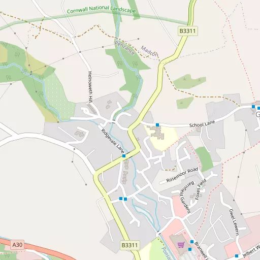
Trevarrack lies within Cornwall. Local places nearby include Trythogga only 279 m South South West, Gulval only 518 m East, Chyandour around 675 m South East, Treneere only 997 m West South West and Heamoor just 1.7 km West South West. Other nearby hamlets and settlements include Newtown, Vellanoweth, Trereife and Lower Ninnes.
You may find out something new or interesting if you click a nearby place to see more local information.
Data shown here comes from OS, ONS and OSM under open licence, using the latest public sources available.
⇅
Local Map
⇅
Location Summary
- Trevarrack is located in Cornwall
- Administrative Area: Cornwall
- Ceremonial County: Cornwall
- Historic County: Cornwall
- Region & Country: South West / England
⇅
Nearby Towns & Cities


⇅
Nearby Localities


⇅
Smaller Settlements
- Newtown 2.8 km E
- Vellanoweth 3.3 km ENE
- Trereife 3.4 km SW
- Lower Ninnes 3.6 km NW
- Tremethick Cross 3.8 km WSW
- Tregavarah 3.8 km WSW
- Mulfra 3.8 km NW
- Boswarthen 4.0 km WNW
- Carfury 4.1 km WNW
- Tredinneck 4.6 km NW


⇅
Other places with this name
- Trevarrack, Cornwall6.8 km NNE
⇅
Beaches
- Kenneggy Sand9.0 km ESE
- Long Rock1.3 km ESE
- Perran Sands6.6 km ESE
⇅
Parks
- Lanner Moor25.5 km ENE
- Palm Cross Green119.0 km ENE
- Summerleaze Down104.5 km NE
- Trungle Moor5.0 km SSW

⇅
Woods
- Bog Plantation3.0 km E
- Hellangove Plantation2.2 km NNE
- Price's Folly4.3 km SSW
- Stennacks Plantation3.3 km E
⇅
Hills
- Castle-an-Dinas3.3 km N
- Lescudjack Hill809 m SSW
- Mulfra Hill4.7 km NW
- Rose Hill4.1 km E

⇅
Lakes
- Boscathnoe Reservoir2.7 km WSW
- Drift Reservoir5.2 km WSW
- Nance Fishing Lakes6.8 km NNE
- Sheffield Quarry5.5 km SSW
⇅
Waterfalls
- Golitha Falls82.8 km ENE
- White Lady Waterfall114.2 km ENE
- Yealm Steps117.9 km ENE
⇅
Headlands
- Cudden Point8.1 km ESE
- Gurnard's Head8.3 km NW
⇅
Islands
- St Michael's Mount4.0 km ESE
- The Enys10.9 km WNW
⇅
Wetlands
- Marazion Marsh3.3 km E
- Basore Point5.7 km ESE
- Arch Zawn8.0 km ESE
⇅
Health Services
- West Cornwall HospitalHospital 1.5 km SW
- PengarthHospital 1.8 km SSW
- Ponsandane Nursing and Residential HomeMedical 541 m S
- Trevaylor Manor Nursing HomeMedical 1.3 km WNW

⇅
Education
- Gulval SchoolSchool 140 m ESE
- St Mary's Roman Catholic SchoolSchool 845 m SW
- Cornwall College of Further and Higher EducationUniversity 20.9 km ENE
⇅
Railway Stations
- Penzance1.2 km S
- St Erth7.5 km NE
⇅
Bus Stations
- Penzance Bus Station1.2 km S
- St Ives9.5 km NNE
⇅
Coach Stations
- Plymouth Coach Station102.1 km ENE
- Torquay Coach Station146.5 km ENE
⇅
Ferry Terminals
- Penzance Ferry Terminal1.7 km S
- Trelissick36.9 km ENE
⇅
Airports
- Land's End Airport10.7 km WSW
- Newquay Cornwall Airport50.1 km NE
⇅
Airfields
- Royal Navy Air Station Culdrose20.6 km ESE
- Predannack Airfield25.7 km SE
⇅
Heliports
- Penzance Heliport1.1 km E
- Cornwall Air Ambulance Station51.2 km NE
⇅
Harbours
- Newlyn Harbour3.4 km SSW
- Mousehole Harbour5.5 km S