
Tresillian
About Tresillian
Tresillian sits within Cornwall. Among the nearby places are Probus only 3.8 km East North East, Newham around 4.2 km South West, Malpas situated 4.3 km South South West, St Erme situated 4.5 km North North West and Kenwyn situated 4.8 km West. Other rural areas close to here include Merther, St Clement, Freewater and St Michael Penkivel.
You may find extra local information by clicking a nearby place.
Information is sourced from OS, ONS and OSM under open licence, using publicly available datasets.
⇅
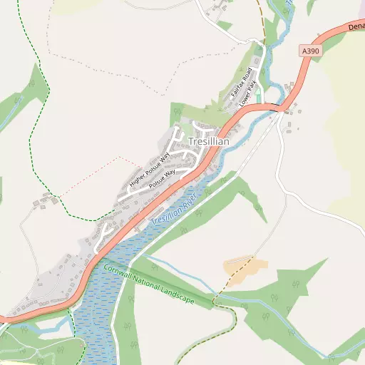
Local Map
⇅
Location Summary
- Tresillian is located in Cornwall
- Administrative Area: Cornwall
- Ceremonial County: Cornwall
- Historic County: Cornwall
- Region & Country: South West / England
⇅
Nearby Towns & Cities
- Penryn 14.2 km SSW
- Falmouth 14.8 km SSW
- St Austell 16.2 km ENE
- Newquay 16.3 km NNW
- Truro 4.1 km WSW


⇅
Nearby Localities
- ProbusVillage 3.8 km ENE
- NewhamDistrict 4.2 km SW
- MalpasVillage 4.3 km SSW
- St ErmeVillage 4.5 km NNW
- KenwynDistrict 4.8 km W
- TrispenVillage 4.9 km NNW
- Ruan LanihorneVillage 5.0 km SE
- LadockVillage 5.4 km NNE
- HighertownDistrict 5.8 km WSW
- ShortlanesendVillage 6.0 km W


⇅
Smaller Settlements
- Merther 1.4 km S
- St Clement 2.8 km SSW
- Freewater 4.1 km E
- St Michael Penkivel 4.2 km S
- Lamorran 4.6 km SSE
- Idless 4.6 km WNW
- Old Kea 4.9 km SSW
- Calenick 5.4 km SW
- New Mills 5.7 km W
- Truthan 5.7 km NNW


⇅
Beaches
- Carne Beach9.1 km SSE
- Loe Beach9.1 km SSW
- Pendower Beach8.9 km SSE
⇅
Parks
- Lanner Moor15.6 km WSW
- Palm Cross Green79.1 km E
- Summerleaze Down69.6 km NNE
- Trungle Moor44.6 km WSW
⇅
Woods
- Hut Plantation1.0 km SW
- Morses Wood1.3 km NE
- Polsue Wood1.0 km WSW
- The Rookery1.3 km WSW

⇅
Hills
- Crow Hill8.9 km NE
- Puckey's Hill9.9 km SE
- Trendeal Hill7.2 km NNE
- Zelah Hill8.0 km NW

⇅
Lakes
- Merther Pond2.6 km SSW
- New Mills Pond7.1 km NNE
- Tresemple Pond1.9 km SSW
- Wheal Maid Tailings12.3 km WSW
⇅
Waterfalls
- Golitha Falls42.2 km NE
- White Lady Waterfall73.5 km ENE
- Yealm Steps77.0 km ENE
⇅
Headlands
- Restronguet Point9.8 km SSW
- Roseland Peninsula8.2 km S
⇅
Islands
- Porth Island17.3 km NNW
- The Island16.6 km NNW
⇅
Wetlands
- Malpas Point4.0 km SSW
- Woodbury Point4.3 km SSW
- Victoria Point4.3 km SSW
⇅
Health Services
- Treliske HospitalHospital 6.8 km W
- Falmouth HospitalHospital 14.9 km SSW
- PenairMedical 2.0 km WSW
- Cathedral View Nursing and Care HomeMedical 4.7 km W
⇅
Education
- Pencalenick SchoolSchool 1.2 km SW
- Penair SchoolSchool 2.4 km WSW
- Penryn CampusUniversity 14.8 km SW
⇅
Railway Stations
- Truro5.0 km WSW
- Newlyn Halt9.6 km NNW
⇅
Bus Stations
- Truro Bus Station4.0 km WSW
- Newquay Bus Station16.4 km NNW
⇅
Coach Stations
- Plymouth Coach Station61.5 km E
- Torquay Coach Station105.9 km ENE
⇅
Ferry Terminals
- Philleigh7.0 km SSW
- Trelissick7.0 km SSW
⇅
Airports
- Newquay Cornwall Airport18.3 km N
- Land's End Airport51.8 km WSW

⇅
Airfields
- Truro Airfield10.3 km W
- Perranporth Airfield14.2 km WNW
⇅
Heliports
- Cornwall Air Ambulance Station17.4 km N
- Penzance Heliport40.1 km WSW
⇅
Harbours
- St Mawes Harbour13.7 km S
- Penryn Harbour13.8 km SSW