
Old Kea
About Old Kea
Old Kea, in Cornwall, has Malpas lying 796 m North, Newham situated 2.4 km North West, Penelewey situated 2.9 km West South West and Playing Place lying 3.0 km West. Other rural communities nearby include Coombe, St Michael Penkivel, St Clement, Trelissick and Calenick.
You may notice something interesting if you explore one of the nearby places.
The details shown here use OS, ONS and OSM data provided under open licence.
⇅
Local Map
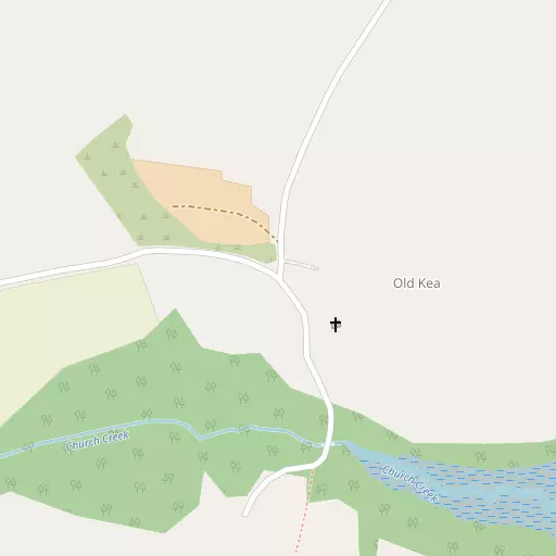
⇅
Location Summary
- Old Kea is located in Cornwall
- Administrative Area: Cornwall
- Ceremonial County: Cornwall
- Historic County: Cornwall
- Region & Country: South West / England
⇅
Nearby Towns & Cities


⇅
Nearby Localities
- MalpasVillage 796 m N
- NewhamDistrict 2.4 km NW
- PeneleweyVillage 2.9 km WSW
- Playing PlaceVillage 3.0 km W
- FeockVillage 3.8 km SSW
- Carnon DownsVillage 4.5 km WSW
- HighertownDistrict 4.6 km NW
- Trolver CroftVillage 4.6 km SW
- KenwynDistrict 4.7 km NW
- TresillianVillage 4.9 km NNE


⇅
Smaller Settlements
- Coombe 1.2 km SSW
- St Michael Penkivel 1.5 km ENE
- St Clement 2.2 km NNE
- Trelissick 2.2 km SSW
- Calenick 2.6 km WNW
- Goonpiper 3.4 km SW
- Lamorran 3.5 km E
- Merther 3.5 km NNE
- Kea 3.6 km WNW
- Philleigh 3.6 km SE


⇅
Beaches
- Loe Beach4.2 km SSW
- Porthbean Beach6.4 km SE
- Porthcurnick Beach6.8 km SSE

⇅
Parks
- Lanner Moor12.3 km W
- Palm Cross Green81.6 km E
- Summerleaze Down74.5 km NNE
- Trungle Moor40.9 km WSW
⇅
Woods
- Barnclose Plantation1.0 km ESE
- Kea Wood728 m NE
- Lambe Wood843 m W
- Penpoll Wood843 m NW


⇅
Hills
- Puckey's Hill9.8 km E
- Trendeal Hill12.1 km NNE
- Tubbon Hill11.0 km WSW
- Zelah Hill11.0 km NNW
⇅
Lakes
- Merther Pond2.3 km NNE
- Swan Pool11.1 km SSW
- Tresemple Pond3.1 km NNE
- Wheal Maid Tailings9.6 km W
⇅
Waterfalls
- Golitha Falls46.4 km NE
- White Lady Waterfall77.7 km NE
- Yealm Steps80.2 km ENE
⇅
Headlands
- Restronguet Point4.9 km SSW
- Roseland Peninsula4.4 km SSE
⇅
Islands
- Porth Island21.4 km N
- The Island20.4 km NNW
⇅
Wetlands
- Victoria Point760 m NNW
- Woodbury Point800 m NE
- Malpas Point963 m NNE
⇅
Health Services
- Treliske HospitalHospital 5.8 km NW
- Falmouth HospitalHospital 10.0 km SSW
- PenairMedical 3.8 km N
- Amberley HouseMedical 4.0 km NW
⇅
Education
- Kea Community Primary SchoolSchool 2.7 km WNW
- Truro SchoolSchool 2.9 km NNW
- Falmouth Marine SchoolUniversity 9.9 km SSW
⇅
Railway Stations
- Truro4.2 km NW
- Perranwell6.6 km WSW
⇅
Bus Stations
- Truro Bus Station3.3 km NNW
- Camborne Bus Station19.6 km W
⇅
Coach Stations
- Plymouth Coach Station64.4 km ENE
- Torquay Coach Station108.9 km ENE
⇅
Ferry Terminals
- Trelissick2.2 km S
- Philleigh2.2 km S

⇅
Airports
- Newquay Cornwall Airport22.8 km N
- Land's End Airport48.4 km WSW
⇅
Airfields
- Truro Airfield9.5 km WNW
- Perranporth Airfield15.1 km NW
⇅
Heliports
- Cornwall Air Ambulance Station22.0 km N
- Penzance Heliport36.7 km WSW
⇅
Harbours
- Penryn Harbour9.0 km SSW
- St Mawes Harbour9.2 km S