
Venn Ottery
About Venn Ottery
Venn Ottery sits within Devon. Places nearby include Metcombe around 1.1 km North East, Harpford only 1.4 km South East, Burrow just 1.5 km South South West and Tipton St John around 1.5 km East North East. Other rural places nearby include Southerton, Coombe, Hawkerland, Stowford and Marsh Green.
You may find out something new or interesting if you click a nearby place to see more local information.
The details shown here use OS, ONS and OSM data provided under open licence.
⇅
Local Map
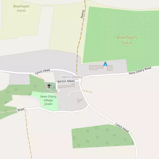
⇅
Location Summary
- Venn Ottery is located in Devon
- Administrative Area: Devon
- Ceremonial County: Devon
- Historic County: Devon
- Region & Country: South West / England
⇅
Nearby Towns & Cities
- Ottery St Mary 4.6 km NNE
- Sidmouth 5.8 km SE
- Budleigh Salterton 9.4 km S
- Topsham 11.8 km WSW
- Exeter 16.1 km W


⇅
Nearby Localities
- MetcombeVillage 1.1 km NE
- HarpfordVillage 1.4 km SE
- BurrowDistrict 1.5 km SSW
- Tipton St JohnVillage 1.5 km ENE
- Newton PopplefordVillage 1.6 km SSE
- West HillVillage 2.8 km NNW
- BowdVillage 3.1 km ESE
- WiggatonVillage 3.3 km NE
- Colaton RaleighVillage 3.8 km S
- AylesbeareVillage 4.1 km W


⇅
Smaller Settlements
- Southerton 736 m SSW
- Coombe 2.2 km ENE
- Hawkerland 3.4 km SW
- Stowford 3.8 km ESE
- Marsh Green 4.5 km WNW
- Allercombe 4.5 km NW
- Stowford 4.6 km SSW
- Perkin's Village 5.4 km W
- Fairmile 6.0 km N
- Farringdon 6.2 km W


⇅
Beaches
- Chiselbury Beach6.8 km SSE
- Jacob's Ladder5.5 km SE
- Sidmouth Town Beach6.0 km SE
⇅
Parks
- Palm Cross Green57.8 km SW
- Pennsylvania Park15.5 km W
- Pleasure Grounds48.8 km W
- The Lawn18.7 km SW
⇅
Woods
- Alder Grove1.6 km N
- Codley Brake2.0 km N
- Fluxton Plantation1.9 km NNW
- Woolcombes Plantation1.9 km WSW
⇅
Hills
- Aylesbeare Hill2.6 km NW
- Harpford Hill1.9 km SW
- North Hill1.2 km N
- Venn Ottery Hill1.6 km W
⇅
Lakes
- Mill Stream5.7 km S
- Sawmill Reservoir6.3 km SSW
- The Lake5.1 km S
- Woodbrook Reservoir4.7 km ESE
⇅
Waterfalls
- Becka Falls33.7 km WSW
- Broad Falls48.9 km WSW
- Horseshoe Falls42.2 km WSW
⇅
Headlands
- Brandy Head8.0 km S
- Otterton Point9.2 km S
⇅
Islands
- Ore Stone30.8 km SSW
- Thatcher Rock31.4 km SSW
⇅
Wetlands
- Weston Ebb10.1 km ESE
- Greenland11.9 km WSW
- The Ridge12.0 km SW
⇅
Health Services
- Ottery St Mary HospitalHospital 4.2 km NNE
- Sidmouth Victoria HospitalHospital 5.8 km SE
- Sundial Nursing HomeMedical 948 m NE
- Kings Manor Care HomeMedical 4.0 km NNE
⇅
Education
- Tipton St John Church of England Voluntary Aided Primary SchoolSchool 1.0 km NE
- Newton Poppleford Primary SchoolSchool 1.7 km SSE
- RowancroftUniversity 14.4 km W
⇅
Railway Stations
- Whimple7.0 km NNW
- Feniton8.3 km N
⇅
Bus Stations
- Exeter Bus Station15.5 km W
- Taunton Bus Station36.4 km NNE
⇅
Coach Stations
- Torquay Coach Station31.2 km SSW
- Plymouth Coach Station70.3 km WSW
⇅
Ferry Terminals
- Starcross Pier13.8 km SW
- Greenway Quay42.0 km SSW
⇅
Airports
- Exeter Airport8.0 km WNW
- Plymouth City Airport65.3 km WSW
⇅
Airfields
- Farway Common Airfield9.3 km ENE
- Dunkeswell Airfield17.4 km NNE
⇅
Heliports
- Lake Heliport75.3 km WNW
- Cardiff City Heliport84.7 km N
⇅
Harbours
- Lympstone Boat Shelter11.6 km SW
- Old Harbour32.1 km SSW