
Weacombe
About Weacombe
Weacombe is in Somerset. Local places nearby include West Quantoxhead just 791 m North, Bicknoller lying 1.4 km South, Sampford Brett just 2.4 km West South West, Doniford lying 3.1 km North West and Williton around 3.3 km West. Other rural communities nearby include Woolston, Cottiford, Newton and Vellow.
You may find out something new or interesting if you click a nearby place to see more local information.
Information is sourced from OS, ONS and OSM under open licence, using publicly available datasets.
⇅
Local Map
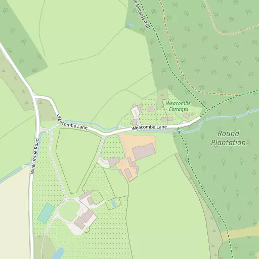
⇅
Location Summary
- Weacombe is located in Somerset
- Administrative Area: Somerset
- Ceremonial County: Somerset
- Historic County: Somerset
- Region & Country: South West / England
⇅
Nearby Towns & Cities
- Watchet 4.7 km WNW
- Wiveliscombe 13.3 km SSW
- Minehead 15.2 km WNW
- Bridgwater 19.0 km E
- Cardiff 36.3 km N


⇅
Nearby Localities
- West QuantoxheadVillage 791 m N
- BicknollerVillage 1.4 km S
- Sampford BrettVillage 2.4 km WSW
- DonifordVillage 3.1 km NW
- WillitonVillage 3.3 km W
- StogumberVillage 3.8 km SSW
- East QuantoxheadVillage 3.8 km NE
- HolfordVillage 4.4 km E
- KilveVillage 4.5 km ENE
- St DecumansDistrict 4.7 km WNW


⇅
Smaller Settlements
- Woolston 1.7 km WSW
- Cottiford 1.7 km SW
- Newton 2.2 km S
- Vellow 2.4 km SW
- Culverhays 2.7 km S
- Higher Halsway 3.0 km SSE
- Kingswood 3.0 km SSW
- Town's End 3.3 km NE
- Capton 3.4 km WSW
- Escott 3.4 km SSW


⇅
Beaches
- Blue Anchor Beach9.5 km WNW
- Dunster Beach11.4 km WNW
- West Street Beach5.0 km WNW
⇅
Parks
- Castle Green36.5 km N
- Cooper's Fields36.7 km N
- Splott Park37.3 km NNE
- Worle Moor32.5 km NE

⇅
Woods
- Haslett Plantation727 m SSE
- Rectory Plantation941 m NNE
- Round Plantation247 m ESE
- Staple Plantation474 m NNE

⇅
Hills
- Beacon Hill1.4 km E
- Stowborrow Hill1.4 km NE
- Weacombe Hill888 m SE
- West Hill1.6 km ENE

⇅
Lakes
- Island Pond5.7 km WSW
- Mare's Pool4.5 km E
- The Swill3.0 km NW
- Wilmot's Pool5.0 km ESE
⇅
Waterfalls
- Berw-ddu63.0 km NNW
- Melin Court Waterfall67.1 km NNW
- Pwll Annie67.3 km N

⇅
Headlands
- Blue Ben3.3 km NNE
- Stert Point18.7 km ENE
⇅
Islands
- Fenning Island18.5 km ENE
- Stert Island19.6 km ENE
⇅
Wetlands
- Swill Point3.4 km NNW
- New Marsh6.9 km SSE
- Kermoor Piling10.1 km WNW
⇅
Health Services
- Williton HospitalHospital 3.5 km W
- Minehead Community HospitalHospital 13.9 km WNW
- Winsor Nursing HomeMedical 14.8 km WNW
- Wey HouseMedical 16.3 km SSE
⇅
Education
- St Peter's First SchoolSchool 3.4 km WNW
- Danesfield Church of England Middle SchoolSchool 3.5 km WNW
- Weston College South West Skills CampusUniversity 31.1 km NE
⇅
Railway Stations
- Williton2.6 km WNW
- Doniford Beach Halt3.4 km NW
⇅
Bus Stations
- Taunton Bus Station19.8 km SE
- Cardiff Bus Interchange35.9 km N
⇅
Coach Stations
- Torquay Coach Station78.4 km SSW
- Millstream Coach Park103.4 km E
⇅
Ferry Terminals
- Newport Transporter Bridge West49.9 km NNE
- Newport Transporter Bridge East49.9 km NNE
⇅
Airports
- Cardiff Airport27.1 km N
- Bristol Airport45.9 km ENE
⇅
Airfields
- Westonzoyland26.0 km ESE
- Maes Awyr Sain Tathan29.7 km NNW
⇅
Heliports
- Cardiff City Heliport35.6 km NNE
- Lake Heliport69.8 km WSW
⇅
Harbours
- Watchet Harbour4.7 km NW
- Lynmouth Harbour39.7 km WNW