
Wotter
About Wotter
Wotter, in Devon, has Shaugh Prior around 1.7 km North West, Lee Moor lying 1.8 km East, Bickleigh around 3.4 km West and Bickleigh Down just 4.3 km West. Other rural settlements include Drakeland Corner, Lovaton, Hoo Meavy, Sheepstor and Roborough.
You might learn something new by clicking through to a nearby place.
These details are compiled from OS, ONS and OSM data released under open licence.
⇅
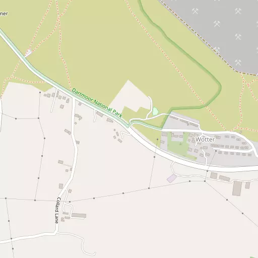
Local Map
⇅
Location Summary
- Wotter is located in Devon
- Administrative Area: Devon
- Ceremonial County: Devon
- Historic County: Devon
- Region & Country: South West / England
⇅
Nearby Towns & Cities
⇅
Nearby Localities
⇅
Smaller Settlements
⇅
Beaches
- Mount Batten
- Pebble Side
- Reform Beach
⇅
Parks
- Palm Cross Green
- Pennsylvania Park
- Pleasure Grounds
- The Lawn
⇅
Woods
- Browns Wood
- Coleland Wood
- Higher Lee Wood
- Lower Lee Wood
⇅
Hills
- Bottle Hill
- Great Trowlesworthy Tor
- Legis Tor
- Stewarts Hill
⇅
Lakes
- Big Pond
- Blachford Fish Pond
- Drakelands Trout Lake
- Yelverton Reservoir
⇅
Waterfalls
- Broad Falls
- Horseshoe Falls
- Yealm Steps
⇅
Headlands
- Hooelake Point
- Pennard's Point
⇅
Islands
- Drake's Island
- Head Weir Island
⇅
Wetlands
- May's Marsh
- Saltram Point
- Arnold's Point
⇅
Health Services
- Plymouth Hospital
- Derriford Hospital
- Devonshire House and Lodge
- Roborough House
⇅
Education
- Shaugh Prior Primary School
- Bickleigh Down Church of England Primary School
- University of St Mark and St John
⇅
Train Stations
- Plymbridge Wood
- Marsh Mills
⇅
Bus Stations
- Kingsbridge Bus Station
- Exeter Bus Station
⇅
Coach Stations
- Plymouth Coach Station
- Torquay Coach Station
⇅
Ferry Terminals
- Barbican Landing Stage
- Mount Batten Passenger Ferry Terminal
⇅
Airports
- Plymouth City Airport
- Exeter Airport
⇅
Airfields
- Bolt Head Airfield
⇅
Heliports
- Cornwall Air Ambulance Station
⇅
Harbours
- Sutton Harbour
- Weston Mill Lake