
Blowinghouse, Redruth
About Blowinghouse
Blowinghouse sits 473 m SE of Redruth in Cornwall. Nearby places include Carn Brea Village just 473 m South East, Tolskithy just 520 m West, Church Town lying 696 m East South East, Illogan Highway only 771 m West and Plain-an-Gwarry around 1.3 km East North East. Other nearby settlements include Tolgus Mount, Penhallick, Piece and Sparnon Gate.
You may find extra local information by clicking a nearby place.
The details shown here use OS, ONS and OSM data provided under open licence.
⇅
Local Map
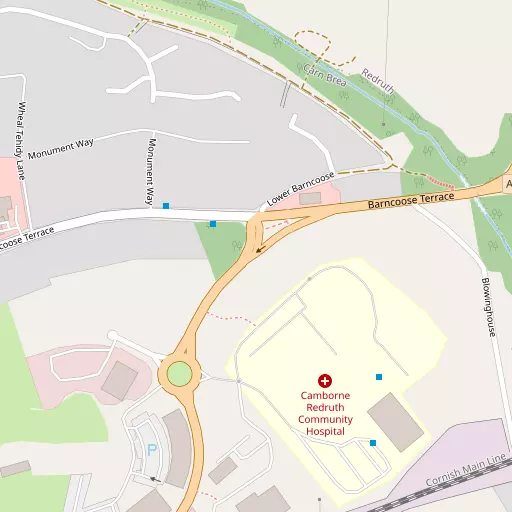
⇅
Location Summary
- Blowinghouse is a neighbourhood in Redruth
- Administrative Area: Cornwall
- Ceremonial County: Cornwall
- Historic County: Cornwall
- Region & Country: South West / England
⇅
Nearby Towns & Cities


⇅
Nearby Localities
- Carn Brea VillageVillage 473 m SE
- TolskithyDistrict 520 m W
- Church TownDistrict 696 m ESE
- Illogan HighwayVillage 771 m W
- Plain-an-GwarryDistrict 1.3 km ENE
- West TolgusDistrict 1.3 km NNW
- PoolVillage 1.6 km W
- IlloganVillage 1.7 km NW
- CarnkieVillage 1.8 km S
- North CountryVillage 2.3 km NNE


⇅
Smaller Settlements
- Tolgus Mount 1.1 km N
- Penhallick 1.8 km SW
- Piece 1.9 km SSW
- Sparnon Gate 1.9 km N
- Gilbert's Coombe 2.1 km NNE
- Treskillard 2.7 km SSW
- Busveal 3.2 km E
- Higher Ninnis 3.3 km E
- Trefula 3.4 km ENE
- Lower Ninnis 3.6 km E


⇅
Beaches
- Gwithian Beach10.5 km W
- Porthtowan Beach6.4 km N
- Portreath Beach5.0 km NW
⇅
Parks
- Lanner Moor4.0 km ESE
- Palm Cross Green97.3 km E
- Summerleaze Down83.3 km NE
- Trungle Moor26.8 km SW

⇅
Woods
- Beech Wood4.3 km WNW
- Bridge Moor4.0 km NNW
- Illogan Woods3.8 km NW
- Nance Wood3.8 km NNW

⇅
Hills
- Carn Brea1.0 km S
- Carn Marth3.1 km ESE
- North Downs3.6 km NE
- Western Hill5.2 km NW
⇅
Lakes
- Boswyn Reservoir6.0 km SSW
- House of Water765 m S
- Stithians Reservoir5.8 km SSE
- Wheal Maid Tailings6.2 km E

⇅
Waterfalls
- Golitha Falls60.0 km ENE
- White Lady Waterfall91.4 km ENE
- Yealm Steps95.5 km ENE
⇅
Headlands
- Gooden Heane Point5.0 km NW
- Tubby's Head8.8 km N
⇅
Islands
- Godrevy Island11.1 km W
- St Michael's Mount20.7 km SW
⇅
Wetlands
- Copperhouse Pool12.7 km WSW
- Weir Point14.2 km ESE
- Pill Point14.7 km ESE
⇅
Health Services
- Camborne Redruth Community HospitalHospital 137 m SE
- Treliske HospitalHospital 11.7 km ENE
- The GreenMedical 1.5 km NE
- FairholmeMedical 3.3 km WSW
⇅
Education
- Redruth School and Technology CollegeSchool 735 m NE
- Treloweth Community Primary SchoolSchool 867 m WNW
- Cornwall College of Further and Higher EducationUniversity 2.1 km W
⇅
Railway Stations
- Redruth1.5 km ENE
- Camborne4.3 km WSW
⇅
Bus Stations
- Camborne Bus Station4.1 km WSW
- Truro Bus Station14.5 km ENE
⇅
Coach Stations
- Plymouth Coach Station79.9 km ENE
- Torquay Coach Station124.3 km ENE
⇅
Ferry Terminals
- Trelissick15.6 km E
- Philleigh15.8 km E
⇅
Airports
- Newquay Cornwall Airport28.6 km NE
- Land's End Airport33.5 km WSW
⇅
Airfields
- Truro Airfield9.2 km NE
- Perranporth Airfield12.1 km NNE
⇅
Heliports
- Penzance Heliport22.0 km WSW
- Cornwall Air Ambulance Station29.3 km NE
⇅
Harbours
- South Harbour12.7 km SE
- Penryn Harbour13.3 km ESE