
Cadbury
About Cadbury
Cadbury is in Devon. Local places nearby include Thorverton situated 3.1 km South South East, Bickleigh around 3.7 km North East, Cheriton Fitzpaine only 4.2 km West North West, Silverton just 4.9 km East South East and Shobrooke just 6.0 km South West. Other nearby hamlets and settlements include Cadeleigh, Chitterley, West Raddon and Uppincott.
You might learn something new by clicking through to a nearby place.
All information is drawn from OS, ONS and OSM under open licence, reflecting the best available public data.
⇅
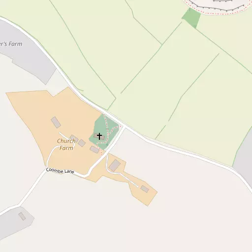
Local Map
⇅
Location Summary
- Cadbury is located in Devon
- Administrative Area: Devon
- Ceremonial County: Devon
- Historic County: Devon
- Region & Country: South West / England
⇅
Nearby Towns & Cities
- Tiverton 8.7 km NNE
- Crediton 9.2 km WSW
- Cullompton 11.1 km ENE
- Topsham 17.7 km SSE
- Exeter 12.4 km S


⇅
Nearby Localities
- ThorvertonVillage 3.1 km SSE
- BickleighVillage 3.7 km NE
- Cheriton FitzpaineVillage 4.2 km WNW
- SilvertonVillage 4.9 km ESE
- ShobrookeVillage 6.0 km SW
- ReweVillage 6.3 km SE
- PoughillVillage 6.6 km WNW
- Brampford SpekeVillage 6.7 km SSE
- ButterleighVillage 7.1 km ENE
- Upton PyneVillage 7.5 km S


⇅
Smaller Settlements
- Cadeleigh 3.0 km N
- Chitterley 3.2 km E
- West Raddon 3.4 km SW
- Uppincott 3.4 km SW
- Stockleigh Pomeroy 3.5 km WSW
- Berrysbridge 3.9 km SSE
- Up Exe 4.0 km SE
- Upham 4.4 km NW
- Efford 4.4 km SSW
- Well Town 4.6 km N


⇅
Beaches
- Cockle Sand24.2 km SSE
- Powderham Sand21.1 km SSE
- Starcross Sand23.9 km SSE
⇅
Parks
- Pennsylvania Park10.8 km S
- Pleasure Grounds33.5 km WSW
- The Lawn28.7 km S
- The Warren56.0 km NW
⇅
Woods
- Castle Plantation440 m NE
- Castle Wood595 m NE
- North Well Penn Plantation528 m ENE
- Steep Hallshot Copse748 m NE
⇅
Hills
- Cat's Hill4.2 km ENE
- Fursdon Hill1.3 km E
- Round Hill1.4 km NNE
- Windmill Down6.1 km NNW

⇅
Lakes
- Allers Ponds11.8 km NNE
- Chub's Pond8.4 km ENE
- Shoebrooke Lake6.8 km SW
- Surry Pond8.8 km SSE
⇅
Waterfalls
- Becka Falls29.0 km SSW
- Broad Falls45.9 km SSW
- Horseshoe Falls39.9 km SSW
⇅
Headlands
- Brandy Head28.1 km SE
- Otterton Point28.4 km SE
⇅
Islands
- Bellpool Island39.8 km SSW
- Island of Rocks38.2 km WSW
⇅
Wetlands
- Duck's Marsh14.3 km S
- West Mud19.1 km SSE
- Greenland19.7 km SSE
⇅
Health Services
- Castle Place PracticeHospital 9.2 km NNE
- Crediton HospitalHospital 10.0 km WSW
- Langford ParkMedical 7.7 km S
- Barton PlaceMedical 9.6 km S
⇅
Education
- Thorverton Church of England Primary SchoolSchool 3.2 km SSE
- Bickleigh-on-Exe Church of England Primary SchoolSchool 3.6 km NE
- Duryard Halls of ResidenceUniversity 10.4 km S
⇅
Railway Stations
- Newton St Cyres6.8 km SSW
- Crediton9.0 km SW
⇅
Bus Stations
- Exeter Bus Station12.1 km S
- Taunton Bus Station36.9 km ENE
⇅
Coach Stations
- Torquay Coach Station40.0 km S
- Plymouth Coach Station66.3 km SW
⇅
Ferry Terminals
- Starcross Pier24.1 km SSE
- Greenway Quay50.3 km S
⇅
Airports
- Exeter Airport14.5 km SE
- Plymouth City Airport60.5 km SW
⇅
Airfields
- Dunkeswell Airfield22.3 km E
- Eggesford Airfield22.6 km W

⇅
Heliports
- Lake Heliport54.1 km WNW
- Hartland Heliport71.1 km WNW
⇅
Harbours
- Lympstone Boat Shelter22.2 km SSE
- Old Harbour41.6 km S