
Collins End
About Collins End
Collins End is in Oxfordshire. Neighbouring places include Whitchurch Hill just 1.7 km West, Cray's Pond just 2.7 km North West, Purley on Thames lying 2.8 km South, Whitchurch-on-Thames around 2.9 km South West and Woodcote around 3.3 km North North West. Other places in the surrounding countryside include Goring Heath, Path Hill, Nuney Green and Cane End.
You may find extra local information by clicking a nearby place.
This page uses OS, ONS and OSM data supplied under open licence.
⇅
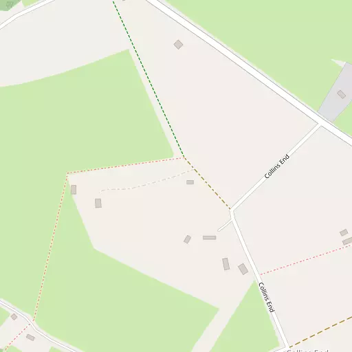
Local Map
⇅
Location Summary
- Collins End is located in Oxfordshire
- Administrative Area: Oxfordshire
- Ceremonial County: Oxfordshire
- Historic County: Oxfordshire
- Region & Country: South East / England
⇅
Nearby Towns & Cities
- Reading 7.9 km SE
- Henley-on-Thames 10.8 km ENE
- Woodley 11.6 km ESE
- Wallingford 11.8 km NNW
- Oxford 30.9 km NNW


⇅
Nearby Localities
- Whitchurch HillVillage 1.7 km W
- Cray's PondVillage 2.7 km NW
- Purley on Thames District 2.8 km S
- Whitchurch-on-ThamesVillage 2.9 km SW
- WoodcoteVillage 3.3 km NNW
- Pangbourne Village 3.3 km SW
- Gallowstree CommonVillage 3.4 km ENE
- Chazey HeathVillage 3.8 km ESE
- Kidmore EndVillage 4.0 km E
- Tokers GreenVillage 4.4 km ESE


⇅
Smaller Settlements
- Goring Heath 743 m NNW
- Path Hill 778 m WSW
- Nuney Green 1.4 km E
- Cane End 2.2 km ENE
- Mapledurham 2.3 km SSE
- Hook End 2.8 km NNE
- Trench Green 2.8 km ESE
- Exlade Street 2.9 km N
- Little Heath 3.1 km NW
- Satwell 6.6 km NE


⇅
Beaches
- Cotswold Hills Beach65.1 km WNW
- Goatee Beach72.4 km SSW
- Weston Point72.3 km SSW


⇅
Parks
- Ascot Heath27.8 km ESE
- Loop Meadow17.7 km NW
- North Croft22.5 km WSW
- The Common6.5 km ESE
⇅
Woods
- Coxsetter's Wood568 m ESE
- Holly Copse501 m SSE
- Holmes's Wood434 m SSW
- Whitehill Plantation508 m WSW
⇅
Hills
- Boze Down2.1 km WSW
- Browns Hill1.9 km ESE
- Greenmoor Hill2.6 km NNW
- Straw Hill1.0 km SSE
⇅
Lakes
- Furzemoor Pond2.5 km WNW
- Hyde's Pond1.2 km NW
- Poplar's Pond2.3 km WNW
- Tinepit Pond2.1 km W
⇅
Waterfalls
- Neptune Waterfall39.3 km ENE
- The Cascade58.1 km N
- Tower Waterfall38.9 km ENE
⇅
Headlands
- Botany Bay Point33.3 km ESE
- Chidham Point75.7 km S
⇅
Islands
- Appletree Eyot4.7 km SSE
- Poplar Island4.6 km SSE
⇅
Wetlands
- Wargrave Marsh12.4 km E
- Midgham Marsh16.4 km SW
- Thatcham Reed Beds19.5 km SW
⇅
Health Services
- Prospect Park HospitalHospital 6.8 km SSE
- Dellwood Community HospitalHospital 7.1 km SSE
- Florence House Nursing HomeMedical 7.2 km SSE
- Parkside Care HomeMedical 7.3 km SSE
⇅
Education
- The Oratory Preparatory SchoolSchool 2.3 km NW
- Whitchurch Primary SchoolSchool 2.4 km SW
- University of ReadingUniversity 8.8 km SE
⇅
Railway Stations
- Pangbourne3.5 km SW
- Tilehurst4.1 km SSE
⇅
Bus Stations
- Bracknell Bus Station23.2 km ESE
- High Wycombe Bus Station24.8 km NE
⇅
Coach Stations
- High Wycombe Coachway23.4 km ENE
- Luton Airport Bus and Coach Station62.5 km NE
⇅
Ferry Terminals
- Hampton Ferry Boathouse48.9 km ESE
- Hammerton's Pier51.6 km E
⇅
Airports
- Wycombe Air Park20.6 km NE
- Blackbushe Airport24.7 km SE
⇅
Airfields
- RAF Benson12.7 km NNW
- Brimpton Airfield15.8 km SSW
⇅
Heliports
- The London Heliport60.6 km E
- Kent Surrey Sussex Air Ambulance109.5 km E
⇅
Harbours
- Chelsea Harbour60.4 km E
- Ocean Dock72.4 km SSW