
Lower Rocombe
About Lower Rocombe
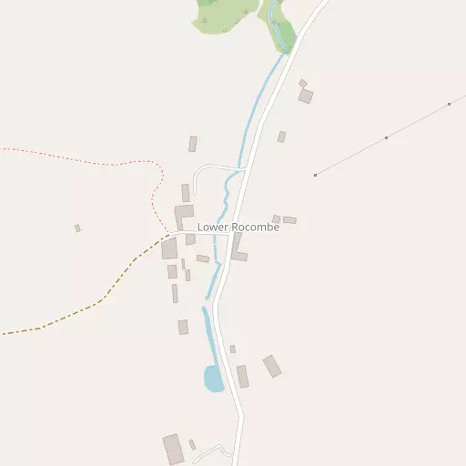
Lower Rocombe lies within Devon. Nearby places include Stokeinteignhead just 696 m East, Maidencombe lying 1.8 km South East, Combeinteignhead lying 1.9 km North West, Ringmore situated 2.4 km North East and Coffinswell just 2.6 km West South West. Other rural communities nearby include Middle Rocombe, Higher Rocombe, Netherton and Daccombe.
You might discover something new by clicking a nearby place for more local details.
Information is sourced from OS, ONS and OSM under open licence, using publicly available datasets.
⇅
Local Map
⇅
Location Summary
- Lower Rocombe is located in Devon
- Administrative Area: Devon
- Ceremonial County: Devon
- Historic County: Devon
- Region & Country: South West / England
⇅
Nearby Towns & Cities
- Teignmouth 4.2 km NE
- Kingsteignton 4.9 km NW
- Newton Abbot 5.1 km WNW
- Torquay 5.8 km S
- Exeter 22.5 km N


⇅
Nearby Localities
- StokeinteignheadVillage 696 m E
- MaidencombeDistrict 1.8 km SE
- CombeinteignheadVillage 1.9 km NW
- RingmoreDistrict 2.4 km NE
- CoffinswellVillage 2.6 km WSW
- NewtakeDistrict 2.8 km W
- BartonDistrict 2.9 km S
- Aller ParkDistrict 2.9 km W
- WatcombeDistrict 2.9 km SSE
- ShaldonVillage 3.0 km NE


⇅
Smaller Settlements
- Middle Rocombe 706 m S
- Higher Rocombe 1.3 km SSE
- Netherton 2.2 km WNW
- Daccombe 2.2 km SSW
- North Whilborough 5.4 km SW
- Humber 5.6 km N
- Two Mile Oak Cross 6.6 km WSW
- Dainton 6.6 km WSW
- Combe 6.8 km NNW
- Luton 6.9 km N


⇅
Beaches
- Cherryred Beach2.8 km ENE
- Maidencombe Beach2.5 km SE
- Whitsand Beach3.2 km SE

⇅
Parks
- Palm Cross Green31.2 km SW
- Pennsylvania Park24.2 km N
- Pleasure Grounds40.1 km NW
- The Lawn8.4 km NE
⇅
Woods
- Great Wood1.2 km SW
- Hitch Beer Copse873 m W
- New Planting1.0 km W
- No Man's Land Plantation559 m WNW
⇅
Hills
- Great Hill2.2 km S
- Kerswell Hill2.9 km SW
- Mincent Hill3.1 km S
- The Beacon2.3 km ENE
⇅
Lakes
- Abbrook Pond6.4 km NW
- Bickley Pond6.0 km SW
- Well Head5.2 km NW
- Zitherixon Clay Works5.1 km WNW
⇅
Waterfalls
- Becka Falls17.9 km WNW
- Broad Falls25.8 km W
- Horseshoe Falls19.8 km W
⇅
Headlands
- Bundle Head2.9 km ENE
- Watcombe Head3.1 km SSE
⇅
Islands
- Ore Stone8.5 km SE
- Thatcher Rock8.0 km SSE
⇅
Wetlands
- Gravel Point2.6 km NNE
- Flow Point2.7 km N
- Netherton Point2.7 km NW

⇅
Health Services
- Teignmouth HospitalHospital 3.7 km NNE
- Torbay Hospital AnnexeHospital 4.0 km SSW
- Lynwood LodgeMedical 2.8 km S
- Mount TryonMedical 6.1 km SSE
⇅
Education
- Stokeinteignhead SchoolSchool 717 m ENE
- Mayfield SchoolSchool 2.9 km SSE
- South Devon College Brunel CentreUniversity 3.9 km WNW
⇅
Railway Stations
- Newton Abbot4.3 km WNW
- Teignmouth4.4 km NE
⇅
Bus Stations
- Exeter Bus Station22.9 km N
- Kingsbridge Bus Station31.3 km SSW
⇅
Coach Stations
- Torquay Coach Station5.2 km S
- Plymouth Coach Station45.8 km WSW
⇅
Ferry Terminals
- Starcross Pier13.6 km NNE
- Greenway Quay15.8 km SSW
⇅
Airports
- Exeter Airport25.5 km NNE
- Plymouth City Airport41.8 km WSW
⇅
Airfields
- Farway Common Airfield35.0 km NE
- Bolt Head Airfield37.7 km SSW
⇅
Heliports
- Lake Heliport75.8 km NW
- Hartland Heliport88.3 km NW
⇅
Harbours
- Old Harbour6.8 km S
- New Harbour6.9 km S