
Newton Abbot
About Newton Abbot
Newton Abbot, in Devon, has Knowles Hill lying 234 m North North East, Abbotsbury situated 332 m North West, Broadlands just 900 m West North West and Wolborough lying 993 m South. Other places in the surrounding countryside include Teigngrace, Netherton, Preston, Two Mile Oak Cross and West Ogwell.
You might discover something new by clicking a nearby place for more local details.
This information is based on OS, ONS and OSM data released under open licence.
⇅
Local Map
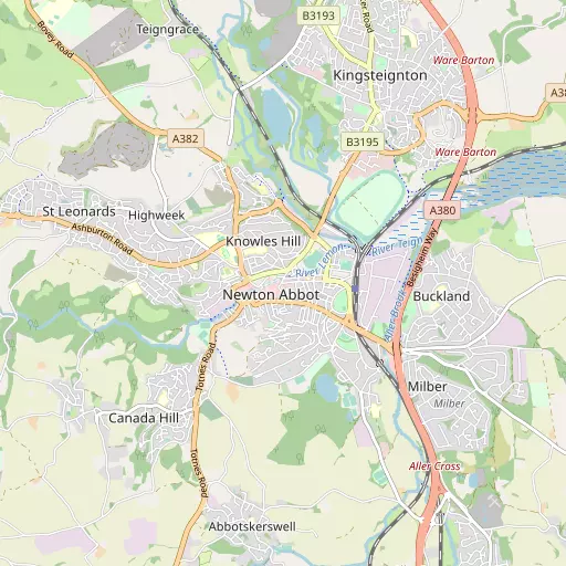
⇅
Location Summary
- Newton Abbot is located in Devon
- Administrative Area: Devon
- Ceremonial County: Devon
- Historic County: Devon
- Region & Country: South West / England
⇅
Nearby Towns & Cities
⇅
Nearby Localities
⇅
Smaller Settlements
⇅
Beaches
- Cherryred Beach
- Maidencombe Beach
- Shaldon Beach
⇅
Parks
- Palm Cross Green
- Pennsylvania Park
- Pleasure Grounds
- The Lawn
⇅
Woods
- Berry's Wood
- Blackball Plantation
- Lang's Copse
- Powsey Moor
⇅
Hills
- Canada Hill
- East Hill
- Emblett Hill
- Gaze Hill
⇅
Lakes
- Abbrook Pond
- Upper Lake
- Well Head
- Zitherixon Clay Works
⇅
Waterfalls
- Becka Falls
- Broad Falls
- Horseshoe Falls
⇅
Headlands
- Bundle Head
- Watcombe Head
⇅
Islands
- Dartington Island
- Hood Island
⇅
Wetlands
- Hackney Marshes
- Buckland Point
- Netherton Point
⇅
Health Services
- Newton Abbot Community Hospital
- Torbay Hospital Annexe
- Bramble Down
- Lynwood Lodge
⇅
Education
- Wolbough Church of England (Aided) Nursery and Primery School
- Bearnes (Voluntary) Primary School
- South Devon College Brunel Centre
⇅
Train Stations
- Teigngrace
- Heathfield
⇅
Bus Stations
- Exeter Bus Station
- Kingsbridge Bus Station
⇅
Coach Stations
- Torquay Coach Station
- Plymouth Coach Station
⇅
Ferry Terminals
- Starcross Pier
- Greenway Quay
⇅
Airports
- Exeter Airport
- Plymouth City Airport
⇅
Airfields
- Bolt Head Airfield
⇅
Heliports
- Lake Heliport
⇅
Harbours
- Old Harbour
- New Harbour