
Mount Pleasant
About Mount Pleasant
Mount Pleasant is in Devon. Nearby places include Offwell only 909 m South East, Wilmington just 2.2 km East, Monkton situated 2.9 km North and Littletown just 3.0 km West South West. Other countryside places nearby include Colwell, Cotleigh, Widworthy, Wick and Church Green.
You may find extra local information by clicking a nearby place.
These details are compiled from OS, ONS and OSM data released under open licence.
⇅
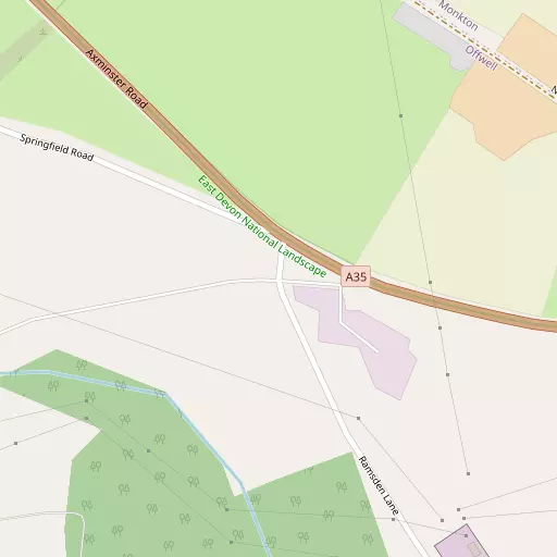
Local Map
⇅
Location Summary
- Mount Pleasant is located in Devon
- Administrative Area: Devon
- Ceremonial County: Devon
- Historic County: Devon
- Region & Country: South West / England
⇅
Nearby Towns & Cities
- Honiton 2.4 km W
- Colyton 8.6 km SE
- Ottery St Mary 10.1 km WSW
- Axminster 11.1 km E
- Exeter 27.8 km WSW


⇅
Nearby Localities
- OffwellVillage 909 m SE
- WilmingtonVillage 2.2 km E
- MonktonVillage 2.9 km N
- LittletownDistrict 3.0 km WSW
- Combe RaleighVillage 3.4 km NW
- HeathparkDistrict 3.8 km W
- HamletDistrict 4.3 km W
- NorthleighVillage 4.4 km SSE
- WestonVillage 4.5 km W
- AwliscombeVillage 5.3 km WNW


⇅
Smaller Settlements


⇅
Other places with this name
Closest
- Mount Pleasant, Dorset 80.2 km E
- Mount Pleasant, Dorset 83.5 km ESE
- Mount Pleasant, Rhondda Cynon Taf - Rhondda Cynon Taf 92.9 km NNW
- Mount Pleasant, Torfaen - Torfaen 101.9 km N
- Mount Pleasant, Castell-nedd Port Talbot - Neath Port Talbot 105.4 km NNW
Furthest away
- Mount Pleasant 473.7 km NNE
- Mount Pleasant 467.0 km NNE
- Mount Pleasant, County Durham 446.9 km NNE
- Mount Pleasant, Stockton-on-Tees 438.7 km NNE
- Mount Pleasant, Norfolk 366.2 km NE

⇅
Beaches
- Branscombe Beach12.4 km S
- Branscombe Ebb12.4 km S
- Seaton Beach11.8 km SSE
⇅
Parks
- Pennsylvania Park26.6 km WSW
- Pleasure Grounds59.6 km W
- The Lawn32.6 km SW
- Yargrass Green57.5 km NE

⇅
Woods
- Colwell Wood325 m SSW
- Offwell Woods992 m SSE
- Scrub Wood412 m SSE
- Spilcombe Copse1.0 km ENE
⇅
Hills
- Crook Hill3.0 km NW
- Honiton Hill827 m W
- Roundball Hill3.3 km WSW
- Widworthy Hill3.3 km ESE
⇅
Lakes
- Huntsman's Pool7.8 km SE
- Mill Pond8.4 km SE
- Rough Grey Pond7.8 km NNW
- Whitford Hole9.1 km ESE
⇅
Waterfalls
- Becka Falls47.0 km WSW
- Broad Falls62.8 km WSW
- Horseshoe Falls56.1 km WSW
⇅
Headlands
- Brandy Head19.7 km SSW
- Otterton Point21.4 km SSW
⇅
Islands
- Ore Stone43.9 km SSW
- Thatcher Rock44.7 km SSW
⇅
Wetlands
- Stafford Marsh10.6 km SE
- Axe Marsh10.8 km SE
- Black Hole Marsh10.9 km SE
⇅
Health Services
- Honiton HospitalHospital 2.3 km W
- Ottery St Mary HospitalHospital 10.9 km WSW
- Honiton Manor Nursing HomeMedical 3.0 km W
- Thornfield Residential HomeMedical 10.6 km SSE
⇅
Education
- Offwell Church of England Voluntary Controlled Primary SchoolSchool 1.0 km SE
- Honiton Primary SchoolSchool 2.4 km WNW
- RowancroftUniversity 26.2 km WSW
⇅
Railway Stations
- Honiton2.2 km W
- Kingsdon9.0 km SE
⇅
Bus Stations
- Taunton Bus Station24.5 km N
- Exeter Bus Station27.1 km WSW
⇅
Coach Stations
- Torquay Coach Station44.9 km SW
- Plymouth Coach Station84.2 km WSW
⇅
Ferry Terminals
- Starcross Pier27.9 km SW
- Greenway Quay55.5 km SW
⇅
Airports
- Exeter Airport19.4 km WSW
- Cardiff Airport68.2 km N
⇅
Airfields
- Farway Common Airfield7.1 km SSW
- Dunkeswell Airfield9.2 km NW
⇅
Heliports
- Cardiff City Heliport74.6 km N
- Lake Heliport81.2 km WNW
⇅
Harbours
- Lympstone Boat Shelter25.6 km SW
- Bridport Harbour29.2 km ESE