
The Point, Exmouth
About The Point
The Point is positioned 2.1 km W from Exmouth in Devon. Nearby places include Cockwood around 2.1 km West, Starcross only 2.1 km West North West, Withycombe Raleigh just 2.3 km North East, Middlewood around 2.3 km West and Hulham around 2.4 km North North East. Other settlements close by include Cofton, Powderham, Woodmanton and Kersbrook.
You might learn something new by clicking through to a nearby place.
All information is drawn from OS, ONS and OSM under open licence, reflecting the best available public data.
⇅
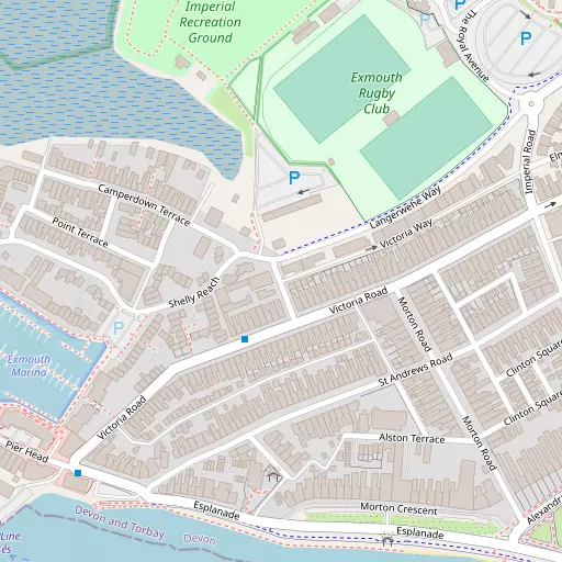
Local Map
⇅
Location Summary
- The Point is a neighbourhood in Exmouth
- Administrative Area: Devon
- Ceremonial County: Devon
- Historic County: Devon
- Region & Country: South West / England
⇅
Nearby Towns & Cities
⇅
Nearby Localities
⇅
Smaller Settlements
⇅
Beaches
- Cockle Sand
- Dawlish Warren Beach
- Exmouth Beach
⇅
Parks
- Palm Cross Green
- Pennsylvania Park
- Pleasure Grounds
- The Lawn
⇅
Woods
- Cofton Copse
- Eastdon Plantation
- Eastdon Wood
- The Plantation
⇅
Hills
- Black Hill
- Easter Hill
- Exwell Hill
- West Down Beacon
⇅
Lakes
- Bystock Fishponds
- Mill Pond
- Ornamental Lakes
- Squabmoor Reservoir
⇅
Waterfalls
- Becka Falls
- Broad Falls
- Horseshoe Falls
⇅
Headlands
- Hole Head
- Otterton Point
⇅
Islands
- Ore Stone
- Thatcher Rock
⇅
Wetlands
- Shelly Bank
- Little Bull Hill
- Great Bull Hill
⇅
Health Services
- Exmouth Hospital
- Langdon Hospital
- Rose Lodge Nursing Home
- Palm Court Nursing Home
⇅
Education
- The Beacon Church of England (Voluntary Aided) Primary School
- Exeter Road Community Primary School
- Plymouth University
⇅
Train Stations
- Exmouth
- Starcross
⇅
Bus Stations
- Exeter Bus Station
- Kingsbridge Bus Station
⇅
Coach Stations
- Torquay Coach Station
- Plymouth Coach Station
⇅
Ferry Terminals
- Starcross Pier
- Greenway Quay
⇅
Airports
- Exeter Airport
- Plymouth City Airport
⇅
Airfields
- Farway Common Airfield
⇅
Heliports
- Lake Heliport
⇅
Harbours
- Lympstone Boat Shelter
- Old Harbour