
Treworlas
About Treworlas
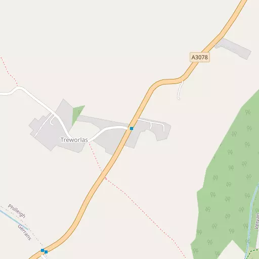
Treworlas, in Cornwall, has Veryan around 2.2 km East North East, Veryan Green situated 2.8 km East North East, Ruan Lanihorne situated 3.5 km North and Portscatho around 3.8 km South South West. Other countryside settlements include Ruan High Lanes, Treworga, Carne, Trewithian and Philleigh.
You may notice something interesting if you explore one of the nearby places.
All information is drawn from OS, ONS and OSM under open licence, reflecting the best available public data.
⇅
Local Map
⇅
Location Summary
- Treworlas is located in Cornwall
- Administrative Area: Cornwall
- Ceremonial County: Cornwall
- Historic County: Cornwall
- Region & Country: South West / England
⇅
Nearby Towns & Cities
- Falmouth 10.7 km SW
- Penryn 11.7 km WSW
- St Austell 18.3 km NE
- Redruth 19.6 km W
- Truro 9.2 km NW


⇅
Nearby Localities
- VeryanVillage 2.2 km ENE
- Veryan GreenVillage 2.8 km ENE
- Ruan LanihorneVillage 3.5 km N
- PortscathoVillage 3.8 km SSW
- GerransVillage 4.1 km SSW
- PortloeVillage 4.7 km ENE
- St Just in RoselandVillage 5.1 km SW
- MalpasVillage 6.5 km NW
- TregonyVillage 6.9 km NNE
- FeockVillage 7.1 km W


⇅
Smaller Settlements
- Ruan High Lanes 1.6 km NNE
- Treworga 1.7 km N
- Carne 1.9 km E
- Trewithian 2.0 km SW
- Philleigh 2.4 km WNW
- Lamorran 3.6 km NNW
- Treviskey 4.5 km ENE
- St Michael Penkivel 5.0 km NW
- Tregenna 5.5 km ENE
- Trelissick 5.8 km W


⇅
Beaches
- Carne Beach1.3 km ESE
- Pendower Beach970 m ESE
- Porthbean Beach2.2 km SSW

⇅
Parks
- Lanner Moor17.3 km W
- Palm Cross Green77.1 km ENE
- Summerleaze Down75.0 km NNE
- Trungle Moor44.8 km WSW
⇅
Woods
- Greendowns Wood3.8 km WNW
- Lamorran Wood3.8 km NNW
- Parson's Hill Wood4.1 km NW
- Penkevel Wood3.6 km NNW
⇅
Hills
- Castle Hill11.7 km ENE
- Crow Hill13.2 km NNE
- Puckey's Hill4.7 km ENE
- Trendeal Hill14.4 km N
⇅
Lakes
- Lizard Pool10.5 km E
- Merther Pond6.3 km NW
- Swan Pool11.7 km SW
- Tresemple Pond7.2 km NW
⇅
Waterfalls
- Golitha Falls44.4 km NE
- White Lady Waterfall75.3 km NE
- Yealm Steps76.3 km ENE
⇅
Headlands
- Nare Head2.7 km SE
- Roseland Peninsula2.8 km WSW

⇅
Islands
- Gull Island20.3 km NE
- The Island24.7 km NNW
⇅
Wetlands
- Gidleywell1.3 km ESE
- Woodbury Point5.6 km NW
- Turnaware Point5.9 km W
⇅
Health Services
- Falmouth HospitalHospital 11.3 km WSW
- Treliske HospitalHospital 11.7 km WNW
- Eshcol HouseMedical 3.7 km SSW
- Roseland Parc Nursing HomeMedical 7.1 km NNE
⇅
Education
- Veryan Church of England Primary SchoolSchool 2.4 km ENE
- Gerrans SchoolSchool 4.2 km SSW
- Falmouth Marine SchoolUniversity 10.7 km SW
⇅
Railway Stations
- Falmouth Docks9.9 km SW
- Truro10.0 km NW
⇅
Bus Stations
- Truro Bus Station9.0 km NW
- Newquay Bus Station24.5 km NNW
⇅
Coach Stations
- Plymouth Coach Station60.2 km ENE
- Torquay Coach Station104.7 km ENE
⇅
Ferry Terminals
- Philleigh5.2 km W
- Trelissick5.5 km W
⇅
Airports
- Newquay Cornwall Airport26.1 km N
- Land's End Airport52.6 km WSW
⇅
Airfields
- Truro Airfield15.5 km WNW
- Perranporth Airfield20.9 km NW
⇅
Heliports
- Cornwall Air Ambulance Station24.9 km N
- Penzance Heliport40.9 km WSW
⇅
Harbours
- St Mawes Harbour7.6 km SW
- Penryn Harbour10.8 km WSW